

The National Weather Service (NWS) has confirmed that a total of seven tornadoes touched down in Walworth, Racine and Waukesha Counties on the evening of Friday, April 17.
That brings the total number of confirmed tornadoes in Southeast Wisconsin to 14 during the week of Sunday, April 12.

The NWS says four EF-0 tornadoes and two EF-1 tornadoes touched down on Friday, all between 6 p.m. and 8 p.m.
First tornado
An EF-1 tornado with estimated peak winds of 100 mph touched down in Walworth County just north of School Section Road in Delavan near the Village of Darien around 6:40 p.m. Friday according to the NWS.

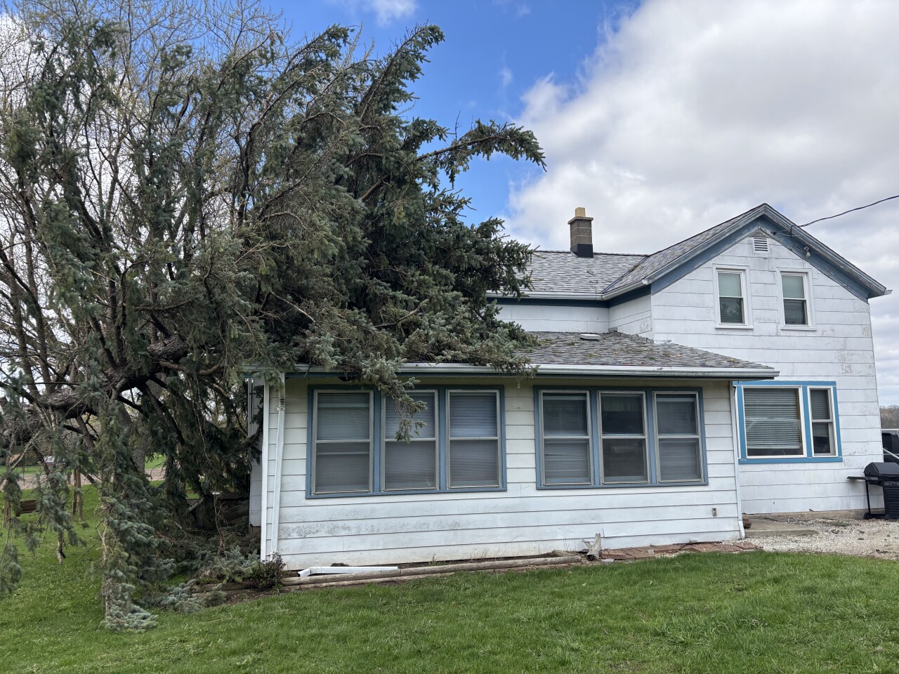
According to the weather service, this powerful tornado traveled along State Road 11 into the Redwood Court neighborhood of Delavan. Pine trees were uprooted and snapped, a few outbuildings had their sheet metal torn off from their roofs and walls and an empty concrete silo was toppled.
Second tornado
An EF-1 tornado with estimated peak winds of 100 mph touched down around 6:46 p.m. in Walworth County near Turtle Creek and Klug Road in Delavan, according to the NWS.

The weather service says this tornado lifted northeastward through the northern portions of Comus Lake by Dam Road. The tornado uprooted or snapped multiple trees along the path, pushed in metal doors on a large metal building and pulled off shingles on a garage and a house.
Third tornado
An EF-0 touched down around 7:22 p.m. in Walworth County along Spring Prairie Road in Burlington just southwest of the unincorporated community of Honey Lake.
The NWS says the tornado was 50 yards wide with peak winds of 70 mph and traveled east-southeast along Spring Prairie Road, uprooting trees, damaging tree limbs, tearing shingles off of nearby roofs and damaging siding on a garage before it ended on Lyons Road.
Fourth tornado
Another EF-0 hit the ground around 7:32 p.m. in Racine County near the intersection of Wisconsin Highway 83 and County Highway O north of Waterford.
This tornado was a bit more powerful than the third, with the NWS estimating a width of 70 yards and peak winds of 70 mph. The weather service says this tornado traveled east while it uprooted and snapped trees while also lifting a porta-potty onto a building, before likely ending in the Tichigan State Wildlife Area.
Fifth tornado
Another, slightly more powerful EF-0 arrived in Waukesha County just south of Muskego around 7:52 p.m. according to the NWS, with a width of 75 yards and estimated peak winds of 70 mph.
The weather service says this tornado started near the intersection of Kelsey Drive and Keiser Lane before heading northeast and causing tree damage. Ultimately, the NWS says it ended in the Big Muskego Lake Wildlife Area northeast of Keiser Lane.
Sixth tornado
The final EF-0 tornado of Friday night touched down in northern Racine County around 7:55 p.m. near the unincorporated community of North Cape on the west side of US-45.
The weather service says this one had estimated peak winds of 80 mph and tracked northeast towards 7 Mile Road, causing damage to a few trees and a barn, whose roof was torn off.
Seventh tornado
The last tornado to touchdown in Southeast Wisconsin on April 17 was an EF-1 which touched down around 7:56 p.m. in northern Racine County, also on the west side of US-45.
This tornado had some of the most powerful wind speeds of any tornado in Southeast Wisconsin on Friday, with estimated peak winds of 100 mph according to the NWS.
After landing in northern Racine County, the weather service says this EF-1 tracked northeast to County Line Road just south of Franklin in Milwaukee County. On its path, the NWS says this tornado snapped and uprooted trees, damaged a barn, damaged house roofs and tore off nearly half of a warehouse's roof.
Straight line wind damage

The weather service also reported damage in Caledonia from estimated 80 mph downburst winds caused by a severe thunderstorm that tracked through the area around 8:11 p.m. Friday.
According to the NWS, the winds caused the total destruction of greenhouse and damage to other outbuildings, with multiple trees being uprooted and leaning on property.

What's next?
Many areas in Southeast Wisconsin are still dealing with flooding concerns due to the large amounts of rain that has caused the Fox River to flood areas like Waukesha, Burlington and Salem Lakes.
Storm Team 4 meteorologists are reporting that the Fox River in Waukesha is receding back to minor flood stage, hoping to bring some relief from fears of flooding in the area.
The Fox River in New Munster, however, could exceed a crest of 15 feet by Sunday.
Milwaukee residents have also had to deal with flooding in areas across the city due to excessive rainfall over the past week.
Storm Team 4 meteorologists are also reporting that the Milwaukee River at Cedarburg in Ozaukee County will crest in a minor flood stage, the Sheboygan River is in a minor flood and the Root River near Raymond in Racine County is in a minor flood.
