

FROM THE NATIONAL WEATHER SERVICE:
***LAKE EFFECT SNOW WARNING FOR WASHINGTON, OZAUKEE, WAUKESHA COUNTIES UNTIL 7:00 A.M. TUESDAY AS WELL AS FOR MILWAUKEE, RACINE, KENOSHA COUNTIES UNTIL 1:00 P.M. TUESDAY.***
***WINTER WEATHER ADVISORY UNTIL 1:00 A.M. TUESDAY FOR DODGE, FOND DU LAC, JEFFERSON, AND WALWORTH COUNTIES; AS WELL AS UNTIL 7:00 A.M. TUESDAY FOR SHEBOYGAN COUNTY.***
- SEVERE WEATHER TOOLS: CLOSINGS | SnowCast | Phone Alerts
YOUR STORM TEAM 4CAST:
One to three inches of snow has already fallen across southeastern Wisconsin before sunrise and it won't stop falling through much of the day today, especially if you live close to Lake Michigan. An area of low pressure is passing to our south and that will bring continued snow across the region all day today though it will be tapering off in the west late this evening as the low moves east, most locations will see 2-3" of additional snow today. Tonight brings around a northeasterly wind tonight, setting up the lake effect snow machine, so while the Winter Weather Advisory will expire in our western counties it will continue in the east as lake effect snow will bring an additional 1-2" of snow. Blowing snow may be an issue for all as the wind will be strong at 10-20mph, gusting to 30mph.
Lake effect snow will gradually taper off Tuesday morning as the wind turns northerly, although it will still be breezy with blowing snow being a potential hazard. The clouds will start to part and we could see a few spots of sunshine before the day comes to a close, temperatures will be cold however with highs dropping into the lower 20s.
The sunshine makes a return as the wind calms down thanks to high pressure on Wednesday but it will be cold for March after the fresh snow with highs in the 20s. Thursday will recover a bit more under sunny skies with temperatures climbing into the mid-30s, though that is still cold for mid-March.
Another storm system arrives on Friday morning, bringing some snowflakes early, changing over to rain by midday with highs climbing into the 40s. We'll stay in the 40s for the weekend with more sunshine expected, a typical March weekend.
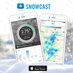 Be sure and try our new SNOWCAST APP! It is the "snow equivalent to STORM SHIELD" - a great new product that gives you high resolution snow forecasts for any part of the nation! It has just been introduced for iPhones, but we are working on the Android version! Just search SNOWCAST in the App Store or SNOWCAST APP! It is the "snow equivalent to STORM SHIELD" - a great new product that gives you high resolution snow forecasts for any part of the nation! It has just been introduced for iPhones, but we are working on the Android version! Just search SNOWCAST in the App Store or click here.
