

MILWAUKEE — It's been an abnormally quiet severe season.
We have gone the longest into the season without a severe warning being issued for southeast Wisconsin. There have only been two weak tornadoes confirmed across the entire state. This all may change Wednesday evening.
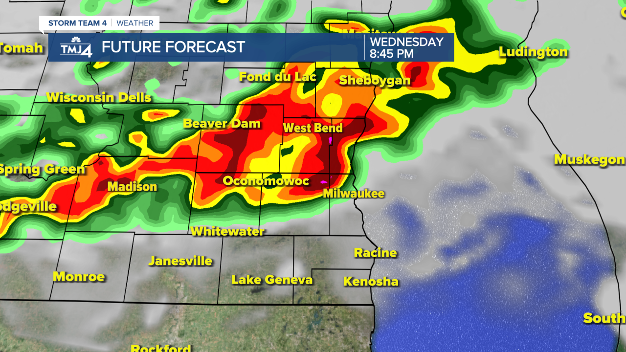
Ingredients are coming together for likely severe weather for a large portion of the state late Wednesday. As of Tuesday, it appears the greatest threats for severe weather Wednesday will be across Western and Central Wisconsin, but I do think it's very possible severe storms make it into our area later in the evening.

Tuesday's update from the NOAA Storm Prediction Center has western Wisconsin under an"Enhanced Risk" for severe weather, with Southeast Wisconsin on the fringe of a "Slight Risk."
I could personally see this changing with an expansion of the "Slight" and "Enhanced" Risks into our area. The forecast storm ingredients would favor multiple bowing lines of storms, resulting in a damaging straight-line wind threat. We can also not rule out isolated tornadoes.

With tens of thousands of fans in the Deer District Wednesday evening, timing is extremely important. As of 12 p.m., it looks like the first round of storms will pass through around 3 p.m. in Western counties and 5 p.m. in Milwaukee. Round two of the storms should come in around 10 p.m.
For now, if you have plans to head to the Deer District... please keep updated with the 4cast. Download the Storm Shield App on your mobile device for interactive radar and real-time severe warnings based on your GPS location. Most importantly, have a plan on where you'll shelter if storms hit.
