

***WINTER WEATHER ADVISORY FRIDAY FROM NOON TO MIDNIGHT
FOR DODGE, FOND DU LAC, JEFFERSON, SHEBOYGAN & WASHINGTON COUNTY**
We'll have a couple storm systems in play as we close out the work week and head into the Holiday weekend. Today will mild and quiet with clouds this morning and sunshine in the afternoon. Temperatures hold steady in the 30s through the day with some melting snow. Tonight's forecast calls for partly cloudy skies and lows in the 20s.
- SEVERE WEATHER TOOLS: CLOSINGS | SnowCast | Phone Alerts
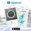 Be sure and try our new SNOWCAST APP! It is the "snow equivalent to STORM SHIELD" - a great new product that gives you high resolution snow forecasts for any part of the nation! It has just been introduced for iPhones, but we are working on the Android version! Just search SNOWCAST in the App Store or SNOWCAST APP! It is the "snow equivalent to STORM SHIELD" - a great new product that gives you high resolution snow forecasts for any part of the nation! It has just been introduced for iPhones, but we are working on the Android version! Just search SNOWCAST in the App Store or click here.
