

Our highs are barely touching 70 today. The average high temperature for today is 80 degrees. I hope you are enjoying these fall-like conditions because our highs hang out in the 70s throughout your 7-day forecast.
Tonight will be cool with mostly clear skies and low temperatures around 50 degrees.
Tomorrow we can expect mostly sunny skies and temperatures in the upper 60s and low 70s. Dew points are dry and comfortable.
Most of the upcoming week looks dry, mild, and comfortable. We may see rain showers on Thursday.
WATCH: Southeast Wisconsin weather: Mostly sunny, and cool temperatures headed into the week
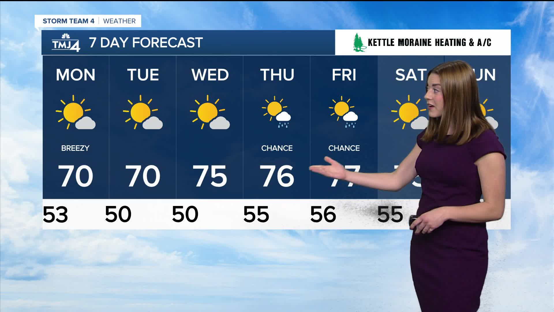
TONIGHT: Mostly Clear
Low: 50
Winds: NW 5-10 mph
MONDAY: Mix of Sun and Clouds
High: 70
Wind: NW 5-15 mph
TUES: Mostly sunny
High: 70
Winds: NW 5-10 mph
WED: Mostly sunny
High: 75
THUR: Partly Cloudy, Chance for showers
High: 77
FRI: Mostly Sunny
High: 77
It’s about time to watch on your time. Stream local news and weather 24/7 by searching for “TMJ4” on your device.
Available for download on Roku, Apple TV, Amazon Fire TV, and more.
