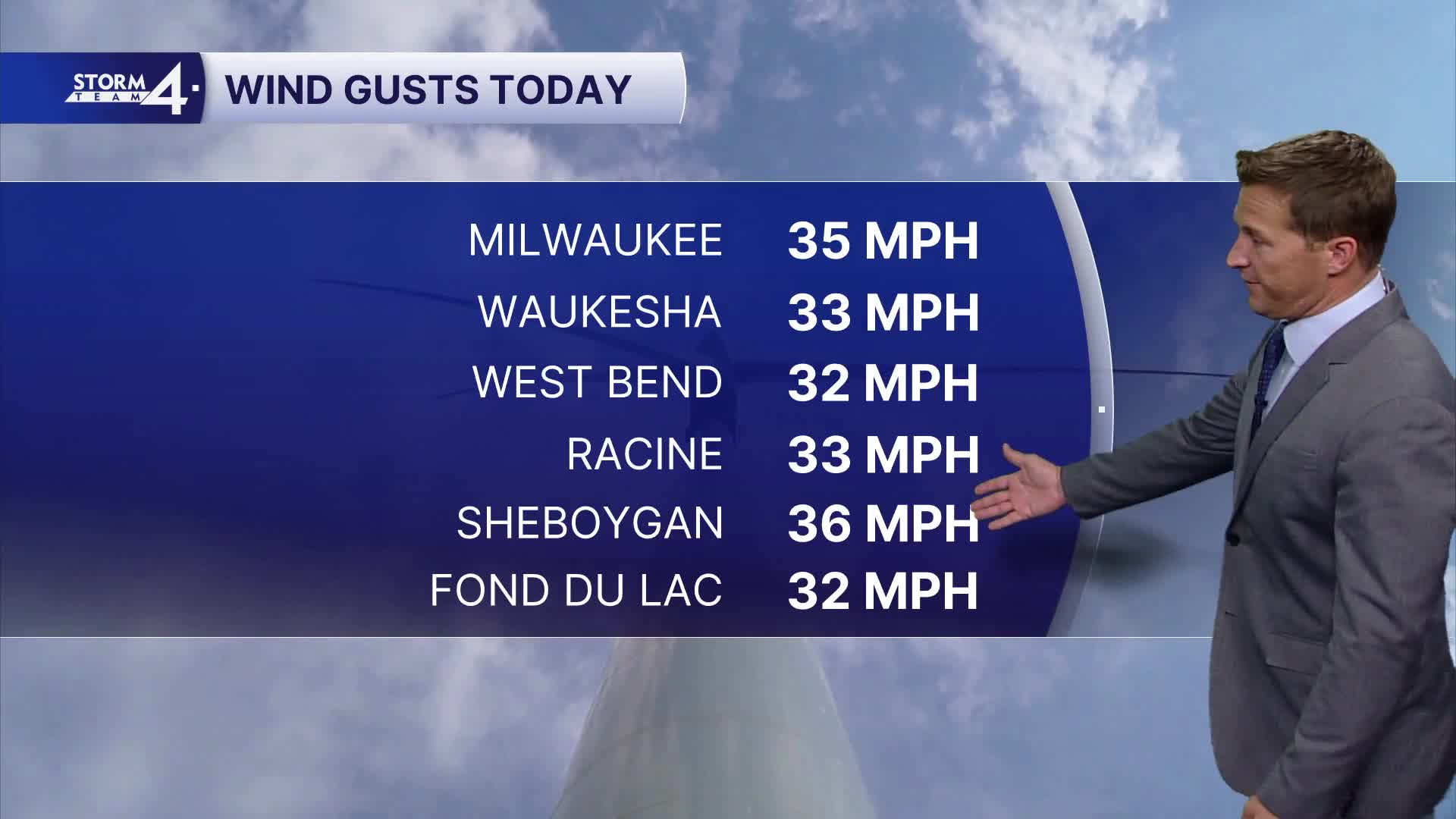


We ended up getting clipped with a few very light showers this morning, mainly north of Milwaukee. The skies eventually cleared out, and the wind picked up. The swirling winds gusted up to 35 mph.
Thankfully, the wind is decreasing this evening.
Watch: When we'll see a big drop in temperatures
The next frontal system brings a decent chance for rain to the area tomorrow night, and a few showers may linger into Friday morning. Up to 0.25" of rain is possible.
We're still watching a strong clipper set to arrive on Saturday evening. Confidence is growing in the likelihood of some snow. The current forecast track would produce a narrow swath of rain and snow across southern Wisconsin. Some accumulation is possible on the grass.
TONIGHT: Mainly Clear
Low: 36
Wind: W 5-10 mph
THURSDAY: Partly Cloudy and Breezy. Rain Likely At Night
High: 54
Wind: S 10-15 mph
FRIDAY: Ch. Morning Showers. Partly Cloudy, Breezy, and Mild
High: 61
SATURDAY: Mostly Cloudy with Rain/Snow Mix Likely Late. Minor Accumulation Possible
High: 43
SUNDAY: Mostly Cloudy and Windy with Flurries Possible
High: 38
It’s about time to watch on your time. Stream local news and weather 24/7 by searching for “TMJ4” on your device.
Available for download on Roku, Apple TV, Amazon Fire TV, and more.
