

Heavy rain and thunder moved through Southeast Wisconsin overnight bringing us almost an inch of rain. As the sun peaked out Sunday afternoon, high were only in the mid 50s. Quite the change from 75 degrees on Saturday.
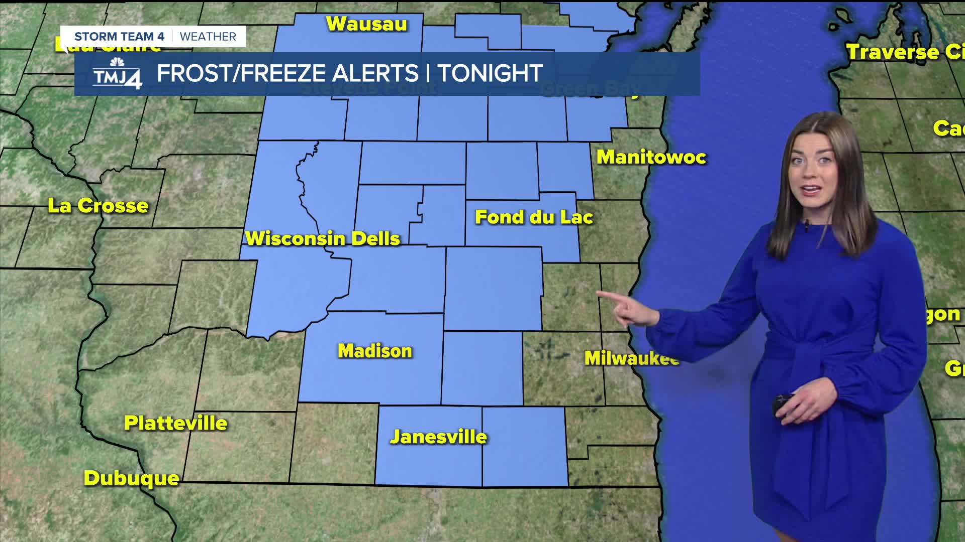
There is a Frost Advisory in effect from 2 a.m. to 8 a.m. on Monday for our inland counties. Temperatures are expected to be in the mid 30s.
Frost may harm sensitive vegetation. Cover your plants! Overnight lows will be near 40 degrees along the lake.
Monday afternoon will warm up nicely with highs in the mid 60s. However, it will still be breezy. Wind gusts expected as high as 30 mph.
Most of the day will be sunny but rain chances increase overnight into Tuesday. Rain totals will stay below a quarter of an inch.
Watch: When we could see more showers
Tuesday will be even cooler with highs in the low 50s. We could see a stray shower and breezy conditions.
After that, things look to be relatively quiet going into next weekend with highs climbing through the 50s then eventually low 60s by next weekend.
SUNDAY NIGHT: Clear, Cool, Windy
Low: 39
Inland: 33
Wind: NW 5-15 MPH.
MONDAY: Mostly sunny and breezy.
High: 65
Wind: S 10-20 mph
TUESDAY: Partly cloudy, breezy and cooler again with
a chance of scattered showers.
High: 55
Wind: W 10-20 mph
WEDNESDAY: Sun and clouds
High: 53
Wind: W 10-20 mph
THURSDAY: Sun and clouds
High: 58
FRIDAY: Sun and clouds
High: 60
It’s about time to watch on your time. Stream local news and weather 24/7 by searching for “TMJ4” on your device.
Available for download on Roku, Apple TV, Amazon Fire TV, and more.
