

After a solid round of rain this morning, the rain has become more scattered this afternoon.
A few more rounds of showers and storms are possible this evening. The severe threat is low, but we'll have to keep an eye on any clearing that could build needed instability for storms, or how close a warm front gets to us from the south.
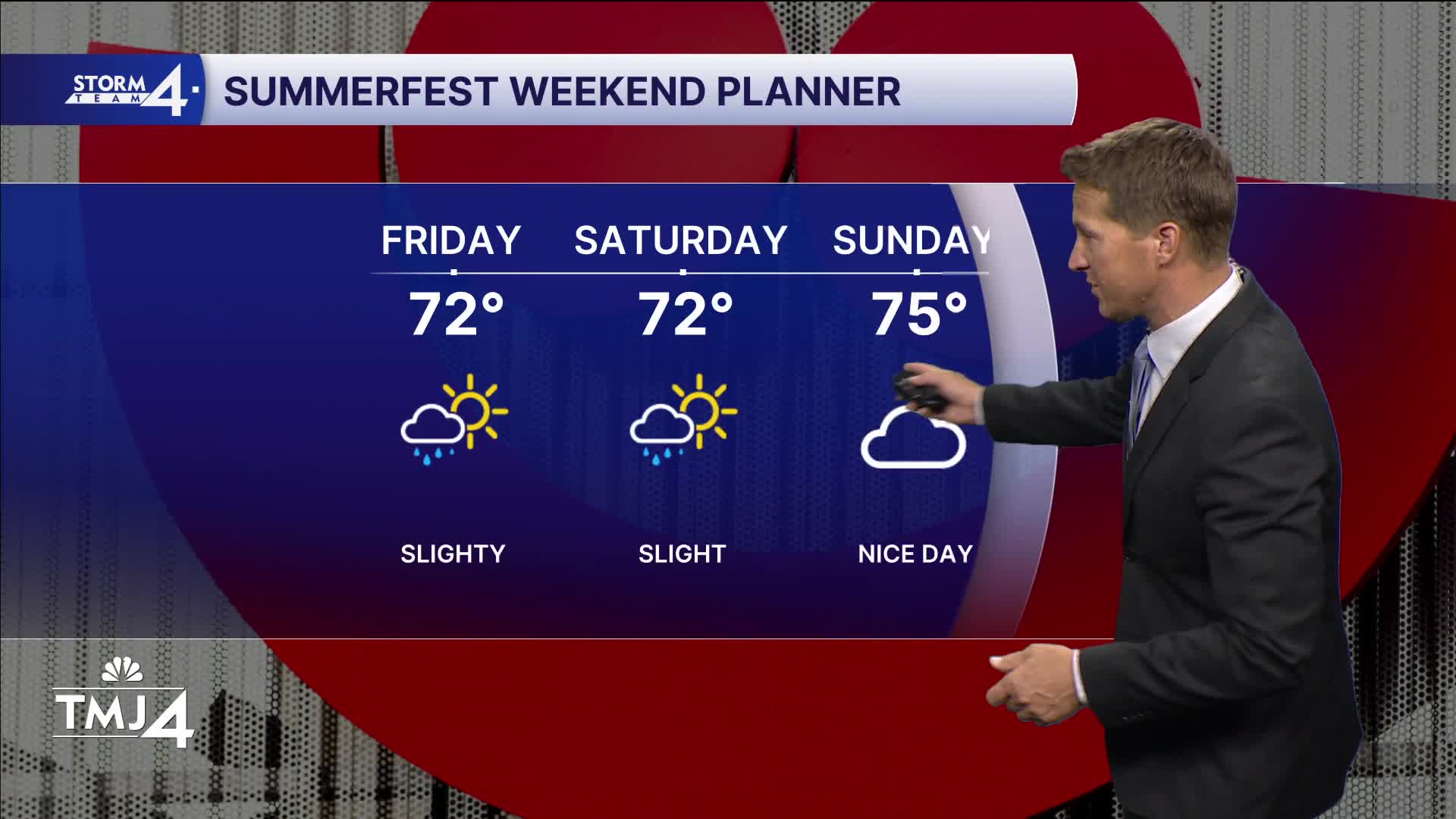
Watch: How's the weekend forecast looking?
Our weather improves on Thursday and Friday. We'll see more sunshine, but we still may get clipped with a stray shower. High temperatures rebound into the 70s.
The weekend is also looking pretty good, but we'll have to watch for more rain on Sunday.
TONIGHT: Scattered Showers
Low: 56
Wind: S to W 10 mph
THURSDAY: Partly Cloudy and Breezy. Slight Ch. Showers
High: 72
Wind: NW 10-20 mph
FRIDAY: Partly Cloudy. Slight Ch. showers
High: 72
SATURDAY: Mostly Sunny
High: 75
SUNDAY: Mostly Cloudy. Ch. Rain South
High: 70
It’s about time to watch on your time. Stream local news and weather 24/7 by searching for “TMJ4” on your device.
Available for download on Roku, Apple TV, Amazon Fire TV, and more.
