

Many of us finally saw our first minor snowfall of the season.
The impacts have been minimal so far with the warmer pavement temps. However, Sunday is going to be blustery and cold during the day with a few stray flurries possible. Highs will only be in the mid to upper 30s with colder wind chills in the teens and 20s.
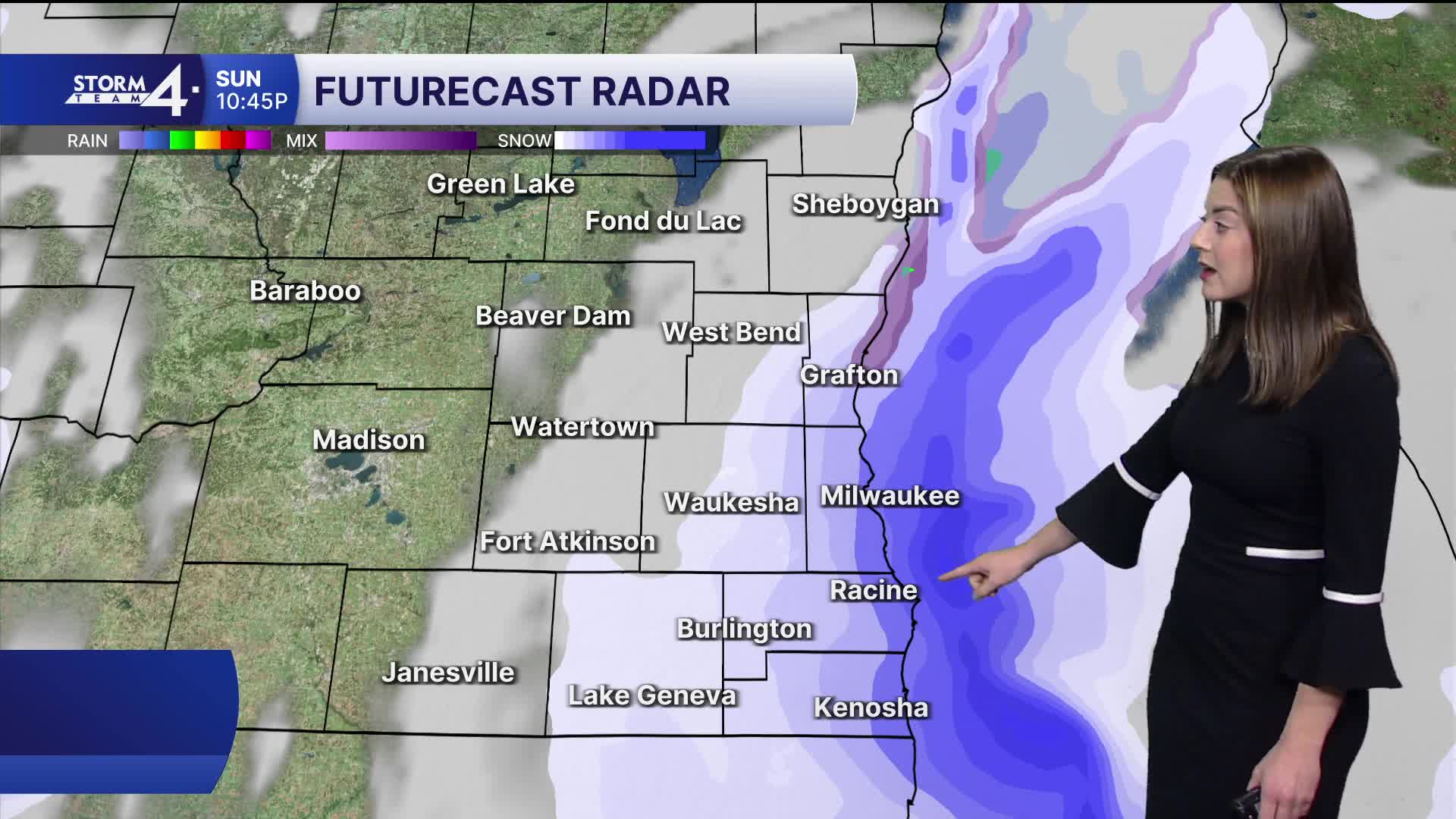
Late Sunday night is the next time frame to watch for a few of us in southern Milwaukee, eastern Racine and eastern Kenosha counties as a narrow lake effect snow band will get close to that area.
There is uncertainty whether this band of snow will make it onshore or now. If it does make it onshore, there may be a few hours late Sunday night with some accumulating snow there.
It's going to be close and may miss that area completely. Lows will be in the mid 20s.
Watch: When and where we could get some snow
We could hold onto a lingering flurry or snow shower on Monday morning before some sun comes out. Monday will also be blustery and cold with highs in the upper 30s.
There will be a small chance of a rain or snow shower Tuesday with highs in the low 40s.
And just like that, the 50s return from Wednesday right into the weekend.
SUNDAY: Mostly cloudy, blustery and cold with a chance of
some flurries or a snow shower.
High: 37.
Wind: NW 10-20 gusting to 30 MPH.
SUNDAY NIGHT: Cold with a chance of some lake effect snow showers late.
Some accumulation is possible in southern Milwaukee, eastern Racine
and eastern Kenosha counties.
Low: 24.
Wind: N 10-15 gusting to 25PH.
MONDAY: Partly cloudy, blustery and chilly with a slight chance of a
few morning flurries or a snow shower
High: 38.
Wind: NW 10-20 gusting to 30 MPH.
TUESDAY: Mostly cloudy and breezy with a slight chance
or a snow or rain shower.
High: 43.
WEDNESDAY: Mostly sunny and not as cold.
High: 50.
THURSDAY: Mostly sunny.
High: 53.
It’s about time to watch on your time. Stream local news and weather 24/7 by searching for “TMJ4” on your device.
Available for download on Roku, Apple TV, Amazon Fire TV, and more.
