

Hi-resolution computer modeling shows some wildfire smoke returning to eastern Wisconsin. Some impacts to air quality are possible, but it will not be as severe or pervasive as the last round of smoke. Sunshine continues through at least Friday before our next chances of rain arrive.
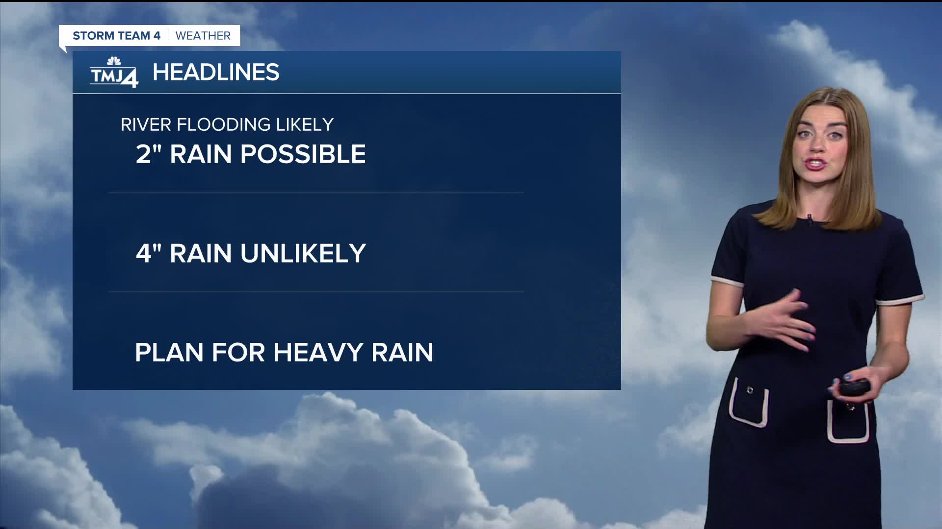
Over the weekend, a corridor of showers/storms sets up across Minnesota and northern Wisconsin. Most of this rain stays North, but any change in track could lead to showers/storms in SE Wisconsin. The best-case scenario involves weekend rain staying North and then drifting southward towards Monday. The worst-case scenario involves rounds of storms that move toward southern Wisconsin over the weekend in addition to the Monday/Tuesday chances of rain. This scenario could lead to a rapid return to flooding conditions.
Watch: When heat, humidity, and rain return
Highs jump into the upper 80s and lower 90s on Saturday and Sunday. Cloud cover and rainfall will cool temperatures off from their peaks.
A cooler trend looks more likely toward the middle of next week.
TONIGHT: Mainly Clear
Low: 65
Wind: Calm
FRIDAY: Mostly Sunny & Warm
High: 84
Wind: S 5-10
SATURDAY: Partly Cloudy, Very Warm, and Humid. Ch. Rain/Storms
High: 88
Wind: SW 5-10
SUNDAY: Partly Cloudy, Very Warm, and Humid. Ch. T-Storms
High: 85
MONDAY: Chance Showers/Storms; Partly Sunny
High: 82
TUESDAY: Chance Showers/Storms
High: 80
It’s about time to watch on your time. Stream local news and weather 24/7 by searching for “TMJ4” on your device.
Available for download on Roku, Apple TV, Amazon Fire TV, and more.
