

After a beautiful spring day, more rain is on the way tonight. You can expect rain to spread across all of southeast Wisconsin after 7 p.m. this evening. The widespread rain likely adds up to around a half inch or a little more by tomorrow morning.
WATCH: Will we be seeing more rain this weekend?
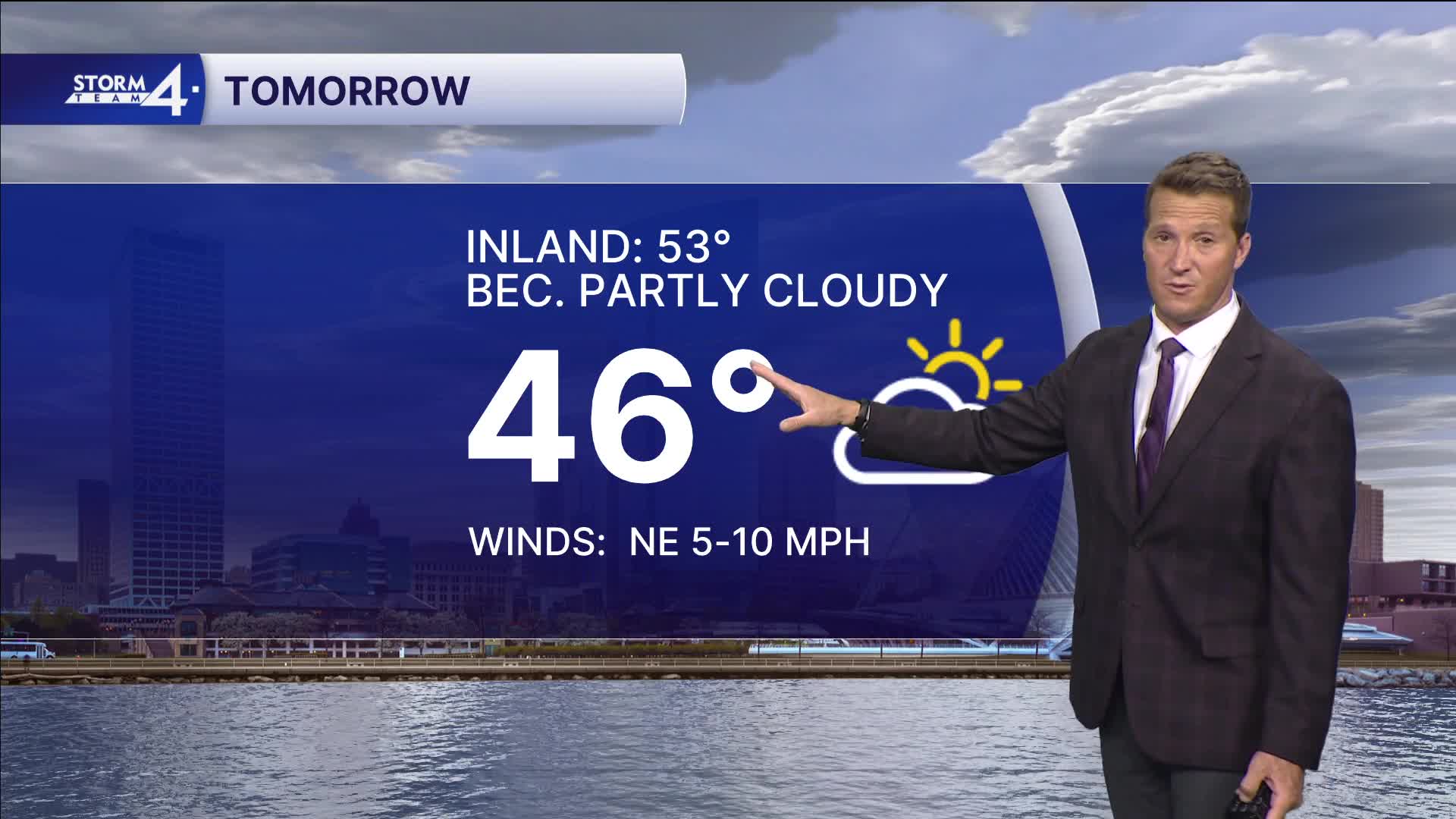
Cooler weather returns tomorrow with highs only reaching the middle 40s lakeside and the lower 50s inland.
The weekend starts nice and dry on Saturday, but showers return Saturday evening.
Warmer air returns Sunday, which will likely lead to thunderstorms.
TONIGHT: Periods of Rain. Around 0.50" Likely
Lows: 40
Wind: E 5 mph
FRIDAY: Bec. Partly Cloudy
High: 46 Lake 53 Inland
Wind: N 5-10 mph
SATURDAY: Partly Cloudy with Ch. Showers Late
High: 51 Lake 58 Inland
SUNDAY: Mild and Breezy with Scattered Showers and Storms
High: 68
MONDAY: Partly Cloudy and Warm
High: 75
It’s about time to watch on your time. Stream local news and weather 24/7 by searching for “TMJ4” on your device.
Available for download on Roku, Apple TV, Amazon Fire TV, and more.
