

Sunday was nice and sunny.
High temperatures should make it to the upper 20s again Sunday night.
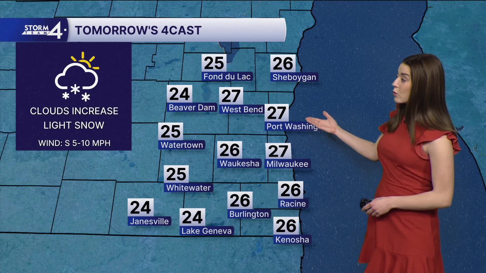
A weak system will also be rolling through Wisconsin Sunday night with some light snow. Any accumulation will be light, under 1".
Monday we will see partly cloudy skies with highs in the upper 20s. Light winds expected, keeping those feels like temperatures in the teens.
Watch: When we could expect temperatures to get above freezing for the first time in weeks.
Midweek is a bit cooler with temps back into the low 20s.
Storm Team 4 is watching the chance for snow on Thursday and Friday.
Forecasted highs are in the low 30s for the first time in weeks.
SUNDAY NIGHT: Partly Cloudy
Low: 18
Wind: N 5 mph
MONDAY: Partly Cloudy
High: 27
Wind: NW 5-10 mph
TUESDAY: Mostly Sunny
High: 22
Wind: N 5-10 mph
WEDNESDAY: Mostly Sunny
High: 23
THURSDAY: Partly Cloudy, Chance Snow
High: 32
FRIDAY: Partly Cloudy, Chance Snow
High: 32
It’s about time to watch on your time. Stream local news and weather 24/7 by searching for “TMJ4” on your device.
Available for download on Roku, Apple TV, Amazon Fire TV, and more.
