

It's quite a bit warmer again today as the breeze made a shift out of the south. It's still a little cooler lakeside, but much of southeast Wisconsin made it into the 80s.
Everyone will likely reach the 80s tomorrow, and humidity will also be on the increase.
Watch the full 7-Day forecast here:
The warmth and humidity will lead to our next chance for rain on Friday.
Periods of showers and storms are likely on Friday. The severe threat is low, and we have a good shot at picking up 0.50" to 1.0" of much-needed rain.
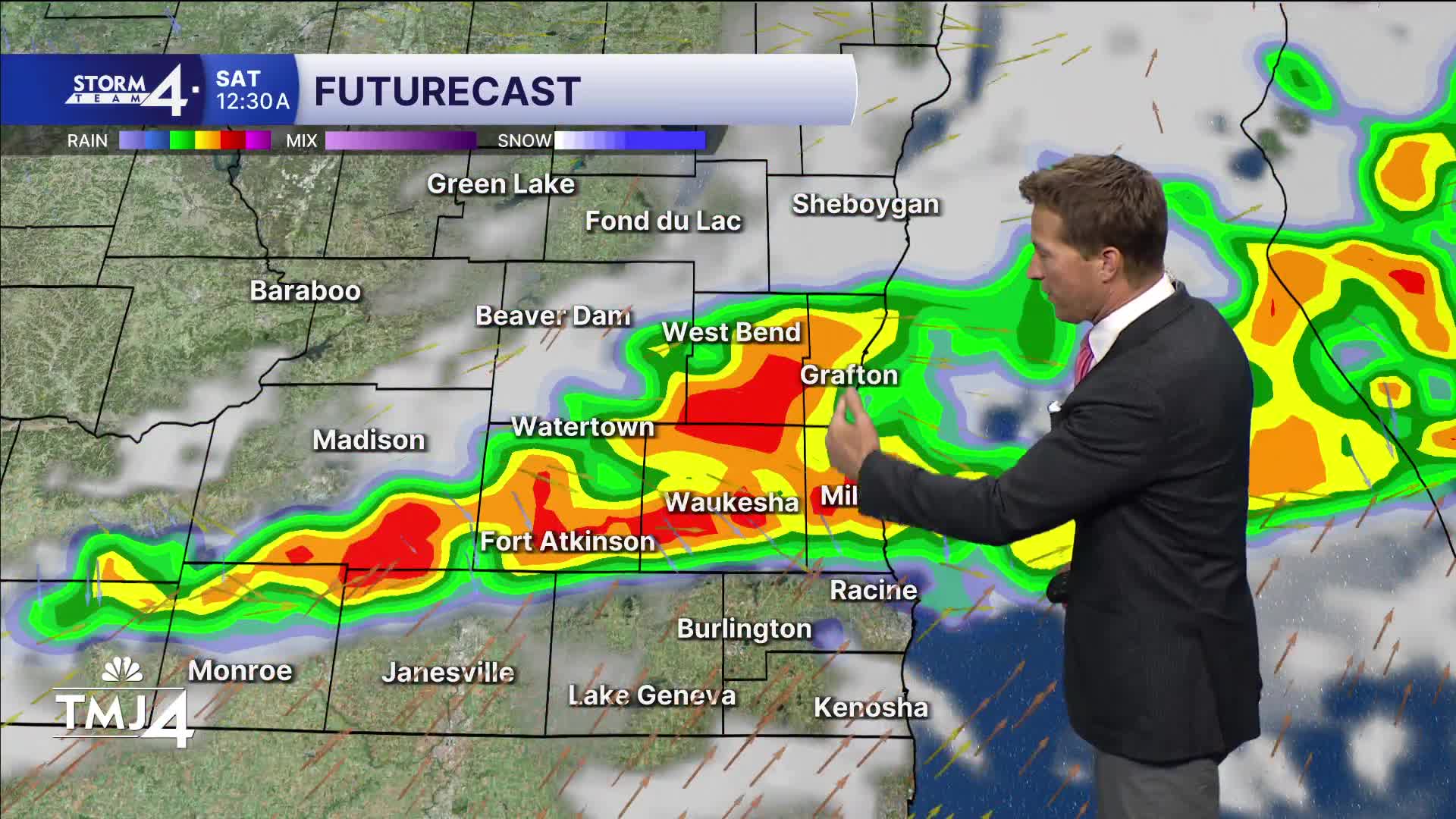
A scattered shower or storm is also possible on Saturday.
TONIGHT: Partly Cloudy
Low: 57
Wind: S 5-10 mph
THURSDAY: Partly Cloudy and Very Warm
High: 86
Wind: S 10-15 mph
FRIDAY: Mostly Cloudy with Rain/Storms Likely. 0.50" to 1.0"
High: 82
SATURDAY: Partly Cloudy. Ch. Shower/Storm
High: 78
SUNDAY: Mostly Sunny
High: 74
It’s about time to watch on your time. Stream local news and weather 24/7 by searching for “TMJ4” on your device.
Available for download on Roku, Apple TV, Amazon Fire TV, and more.
