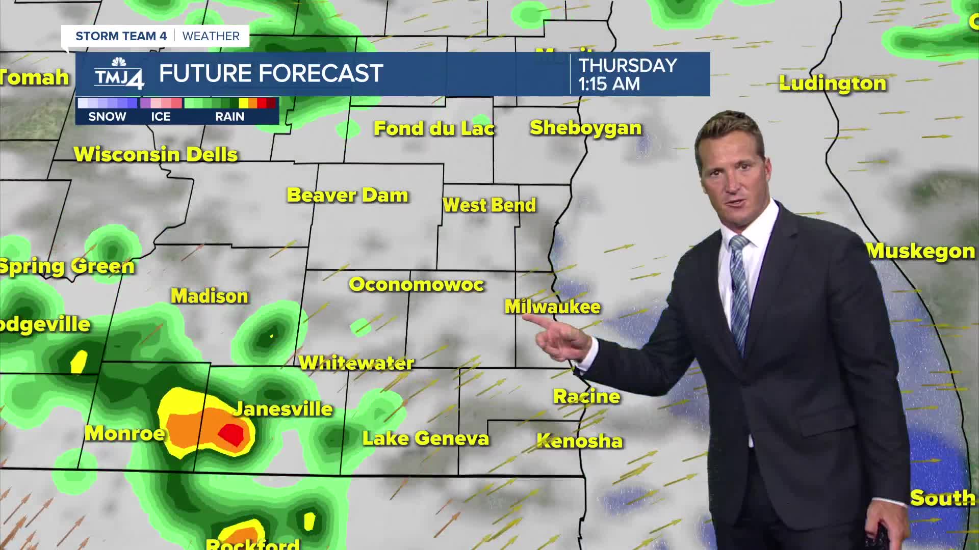


We warmed near 80 degrees today which will set the stage for showers and storms ahead of a cold front tonight. There is a slight chance for a few showers to bubble up early this evening, with a much better chance developing after midnight.
No severe weather is expected, but there may be some brief downpours. These scattered showers will probably linger into tomorrow morning.
Watch: When we could see some chances for rain
Another wave of cool Autumn-like air arrives behind the front tomorrow afternoon. High temperatures by Friday only reach the 60s despite an abundance of sunshine. Temperatures slowly rebound with sunshine through the holiday weekend.
TONIGHT: Scattered Showers and T-Storms
Low: 61
Wind: W 5-10 mph
THURSDAY: Ch. Showers, Mainly Early. Breezy and Cooler.
High: 70
Wind: W to NE 15 mph
FRIDAY: Mostly Sunny
High: 68
SATURDAY: Sunny and Beautiful
High: 71
SUNDAY: Sunny and Very Nice
High: 75
It’s about time to watch on your time. Stream local news and weather 24/7 by searching for “TMJ4” on your device.
Available for download on Roku, Apple TV, Amazon Fire TV, and more.
