

A warm front brought us some early showers and our afternoon temperatures into the 70s. We have been pretty breezy with winds gusting as high as 40 mph at times.
Tonight will be our best shot at widespread rain showers and a better chance for thunderstorms. Severe weather is not expected. It will be breezy and mild with overnight lows in the mid 50s.
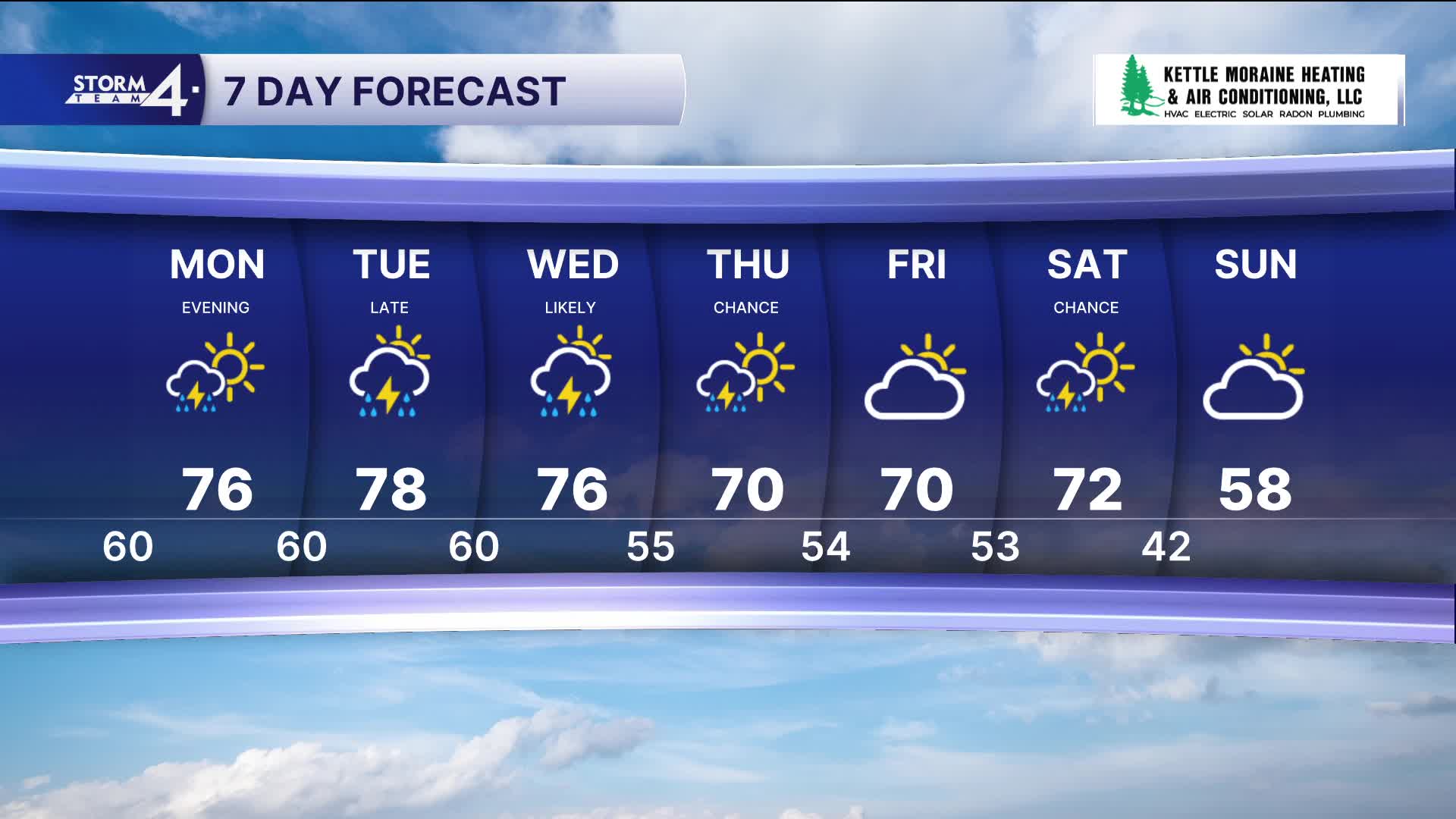
On Monday there will be a small chance of a shower or storm. With the atmospheric ingredients in place, anything that would develop has the chance to be strong to possibly severe. High temperatures will be warm again in the mid 70s and southerly winds as high as 25 mph. The chance for strong storms continues Monday night. On Monday we are in a level 2, slight risk for severe storms.
WATCH: A warm front brought us some early showers and afternoon temperatures into 70
It's the same story for Tuesday with warm, breezy conditions and chances for storms. Highs will top out in the mid 70s. Anything that would develop on Tuesday or Tuesday night has the potential to be strong to severe. Again, we are in a level 2, slight risk for severe storms.
There's a good shot at rain or a few storms on Wednesday.
There are no active river warnings at this moment. Storm Team 4 is monitoring river levels with these ongoing chances for heavy rain.
The end of the week looks to be more mild and dry.
HERE'S YOUR LATEST STORM TEAM WEATHER FORECAST FOR MILWAUKEE
AND SOUTHEASTERN WISCONSIN BY METEOROLOGIST LAUREN LARSEN
TONIGHT: Scattered Rain Showers
Low: 42
Wind: SE 5-10 mph
MONDAY: Partly Cloudy and Warm, Storms Late
High: 78
Wind: S 10 mph
TUESDAY: Partly Cloudy and Warm, Storms
High: 76
WEDNESDAY: Chance Thunderstorms
High: 70
THURSDAY: Partly Cloudy
High: 70
FRIDAY: Mostly Sunny
High: 72
It’s about time to watch on your time. Stream local news and weather 24/7 by searching for “TMJ4” on your device.
Available for download on Roku, Apple TV, Amazon Fire TV, and more.
