

If you looked out the window on Sunday it was almost identical to Saturday.
We saw plenty of sunshine and leaves blowing in the wind. However, as soon as you stepped outside, I am sure you noticed it was significantly colder than Saturday.
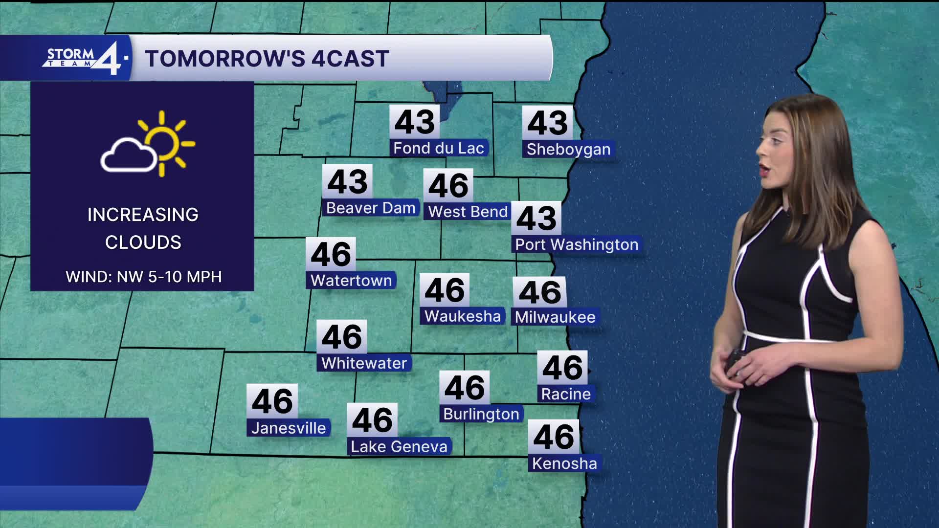
Our highs are normal, in the 40s. That's about 20-25 degrees cooler than Saturday.
Sunday night, we stay with mostly clear skies as temperatures fall into the 20s. Winds begin to quiet down.
Monday is mild with normal temperatures, calm winds, and a mix of sun and clouds.
Watch: When we could see some rain this week (and maybe even snow, for some).
We're watching another chance for rain and snow showers overnight Monday into Tuesday.
There are a few places in Wisconsin that could see a few inches of snow. As the forecast stands on Sunday, Southeast Wisconsin is not expecting accumulating snow.
There is another chance for some rain later into the work week.
Models suggest an area of low pressure to bring wet weather to SE Wisconsin and Northern Illinois. We will have to watch how far north this will reach. Overall, your high temperatures are seasonable.
SUNDAY NIGHT: Clear & COLD
Low: 28
Wind: NW 5-10 mph
MONDAY: Mostly Cloudy
High: 43
Wind: W 5 mph
MONDAY NIGHT: Rain showers and mixed precipitation
Low: 35
TUESDAY: Mostly Cloudy. Showers
High: 43
WEDNESDAY: Partly Cloudy
High:45
THURSDAY: Chance Rain
High: 48
FRIDAY: Rain Possible
High: 51
It’s about time to watch on your time. Stream local news and weather 24/7 by searching for “TMJ4” on your device.
Available for download on Roku, Apple TV, Amazon Fire TV, and more.
