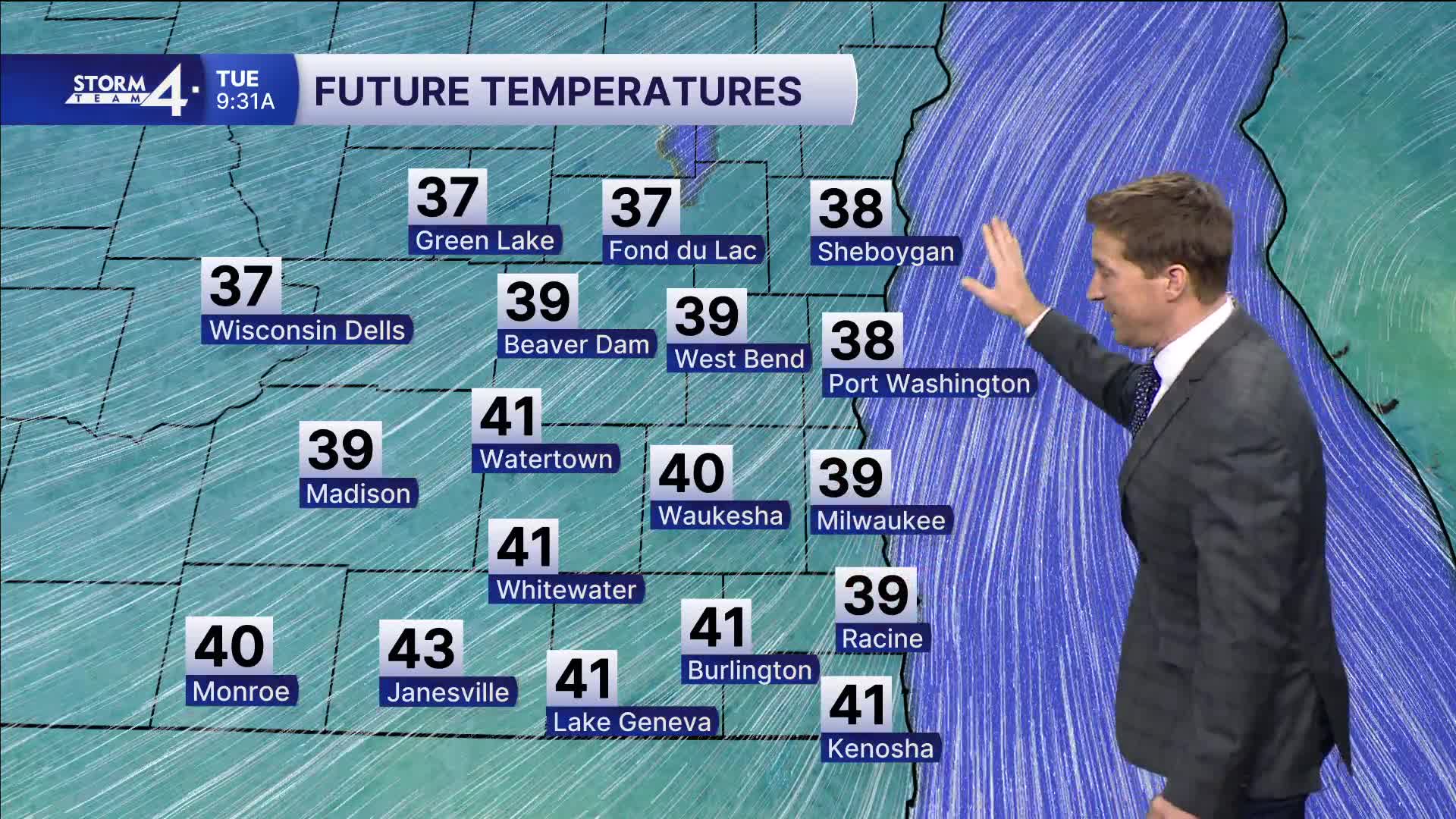


Wow, what a day! Soak this up while you can because we have drastic changes for the rest of the week. The wind shifts northeast overnight, and temperatures quickly drop into the 30s by tomorrow morning. We may not even see 40 degrees tomorrow near Lake Michigan.
WATCH: How long will the sunshine and warm weather last?
The next storm system moves in tomorrow evening, bringing rain showers to southeast Wisconsin. We'll have to closely monitor severe storms that likely fire up across northern Illinois, where it will still be significantly warmer.
Despite being chilly, it is possible for a few thunderstorms to move into southeast Wisconsin, with a large hail threat.
The precipitation changes over to a wintry mix on Wednesday, with slushy minor snow accumulation possible.
A wintry mix may end up being a common theme with multiple chances later this week.
TONIGHT: Mainly Clear
Low: 38
Wind: N 10-15 m
TUESDAY: Partly Cloudy, Breezy, Chilly. Showers Likely By Evening. Ch. T-Storms
High: 42
Wind: NE 10-15 mph
WEDNESDAY: Mix Likely. Less Than 1" Snow
High: 38
THURSDAY: Partly Cloudy. Ch. Mix Late
High: 43
FRIDAY: Chance Snow/Mix
High: 41
It’s about time to watch on your time. Stream local news and weather 24/7 by searching for “TMJ4” on your device.
Available for download on Roku, Apple TV, Amazon Fire TV, and more.
