

Today wasn't quite as warm as other days this week. Our highs were closer to normal, reaching the mid-70s. We still had plenty of sunshine across SE Wisconsin. We are watching some stray showers in the area. A stray shower could impact your Friday night. Most of us will remain dry until after midnight.
Rain chances increase on Saturday. Though no day will be a complete washout, rounds of rain are likely and could deliver up to 1" of rainfall total by Monday morning. Severe weather is not expected. The upper-level low bringing this chance of rain lifts off to the North late in the weekend.
Watch: When showers and storms move in
The unsettled pattern continues into next week. Expect more showers/storms will fire up over the southern Great Lakes and Midwest.
As far as temperatures, we have more 70s through the weekend and early next week.
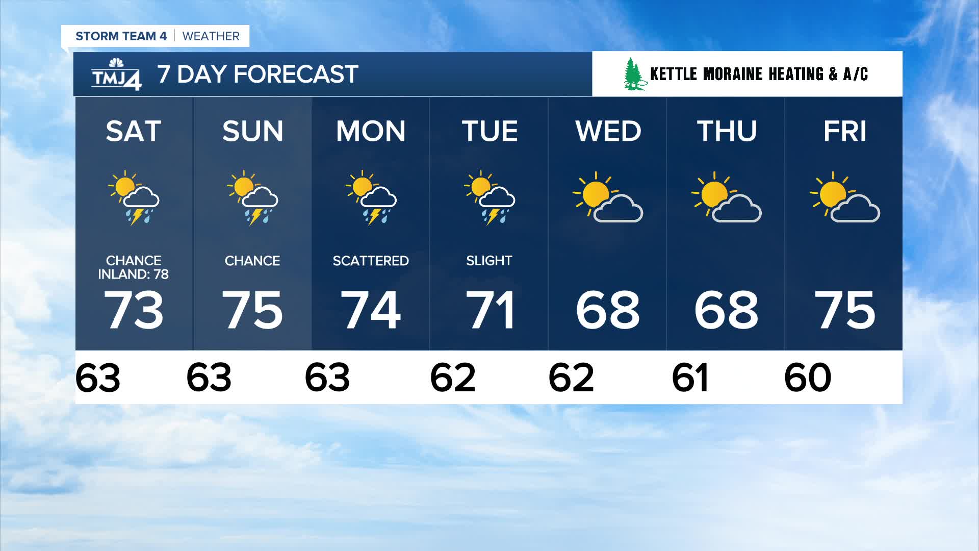
TONIGHT: Partly Cloudy, Scattered Storms
Low: 63
Wind: NE 5 mph
SATURDAY: Scattered Showers/Storms; Partly Sunny
High: 73 Lake 78 Inland
Winds: SE 5-10 mph
SUNDAY: Scattered showers/storms; Partly Sunny
High: 75
Winds: S 5-10 mph
MONDAY: Scattered showers/storms; Mostly Cloudy
High: 75
TUESDAY: Chance showers/storms
High: 73
WEDNESDAY: Sun & Clouds
High: 68
It’s about time to watch on your time. Stream local news and weather 24/7 by searching for “TMJ4” on your device.
Available for download on Roku, Apple TV, Amazon Fire TV, and more.
