

A Winter Weather Advisory will be in effect from 9 p.m. Tuesday through 6 a.m. Wednesday for Racine, Kenosha, Milwaukee, Walworth, Waukesha, and Jefferson Counties.
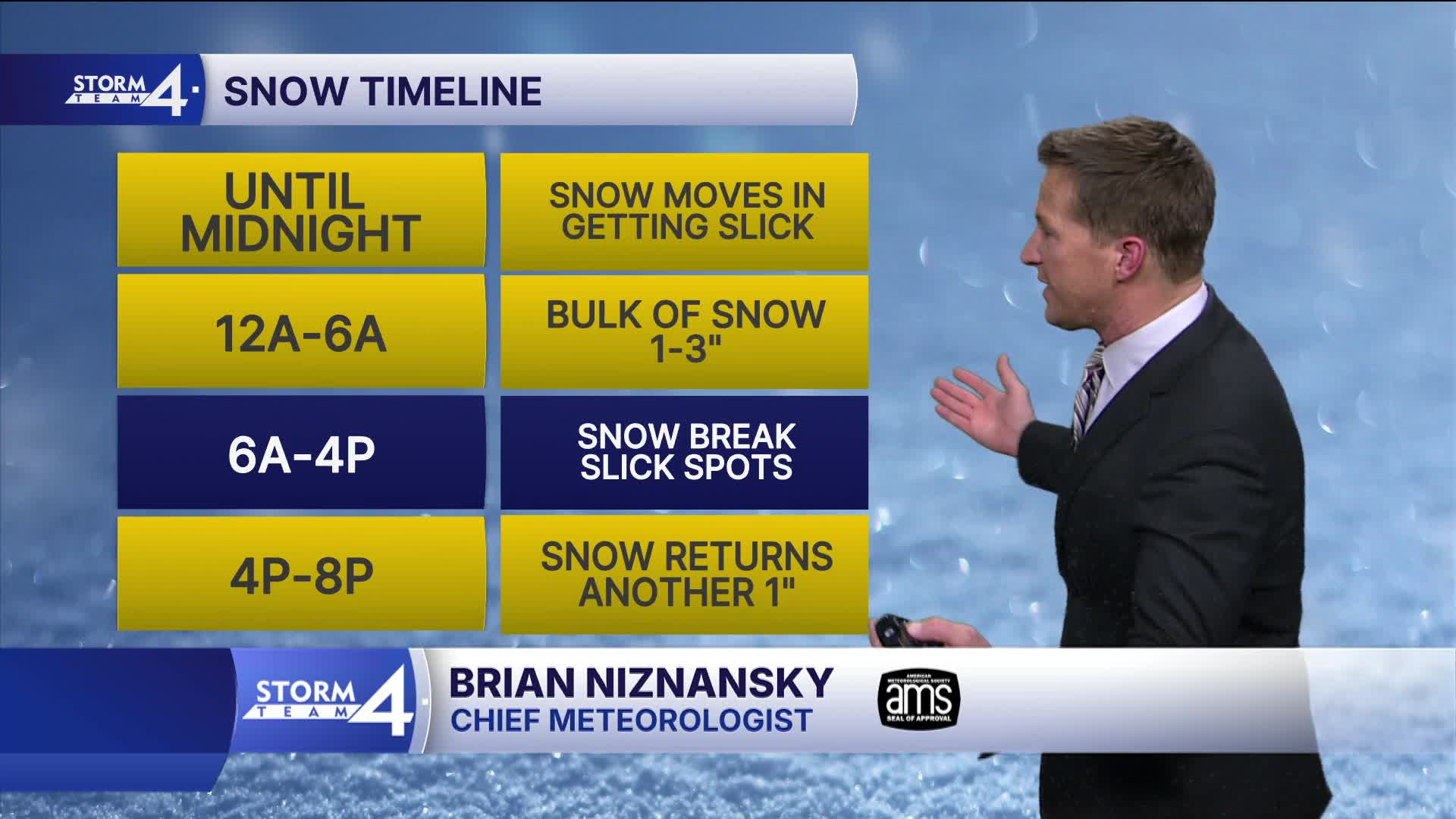
More snow is on the way this evening. Snow spreads across southeast Wisconsin around 9 p.m. and continues much of the night.
It looks like the heaviest snowfall lines up along the Illinois state line. Most locations will pick up 1-3" of snow, with the highest amounts south and the lowest north.
This round of snow should end by sunrise tomorrow morning. Another brief period of snow tomorrow evening could bring us another inch of accumulation.
Watch: How cold is it going to get this week?
The coldest air of the season is on the way Thursday night into Friday morning. The polar vortex dips down as far south as the south end of the Hudson Bay. This will drive true arctic air across the Great Lakes. The temperature may dip as low as -15 on Friday morning, with a wind chill of near -40.
TONIGHT: Snow Likely. 1-3" Accumulation
Low: 12
Wind: SW to W 10 mph
WEDNESDAY: Partly Cloudy. Ch. More Snow Late. 1" Additional
High: 24
Wind: 10-15 mph
THURSDAY: Mostly Cloudy and Cold with Flurries Possible
High: 16
FRIDAY: Partly Cloudy, Windy, and Bitter Cold
High: -3, Wind Chill: -40 to -25
SATURDAY: Mostly Sunny and Still Very Cold
High: 4, Wind Chill: -30 to -15
It’s about time to watch on your time. Stream local news and weather 24/7 by searching for “TMJ4” on your device.
Available for download on Roku, Apple TV, Amazon Fire TV, and more.
