

We have officially broken the record for the most rain on record during the month of April. We have 14 days left this month to keep climbing.
Today was average with partly cloudy skies and temperatures in the mid-50s.
Expect fog to develop tonight with our wet ground, mild temps, and calm winds. Temperatures fall to the mid-40s.
Friday will be warm with temperatures near 80 away from the lake and 70 lake side. Expect partly cloudy skies and breezy southerly winds.
WATCH: When will we see the storms coming to an end?
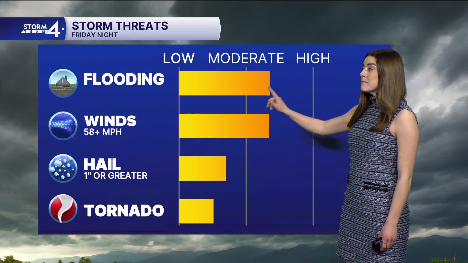
The last thing we need is more rain, but unfortunately, we have more rain on the way Friday night. This also comes with the risk of severe weather. All impacts are possible.
The Storm Prediction Center has SE Wisconsin in a level 2, slight risk for severe weather. A cold front will likely trigger these storms Friday evening.
This weekend looks dry and cool with temperatures below average in the 40s.
We can recover next week as we continue the dry stretch through the beginning of the week.
TONIGHT: Fog Likely
Low: 46
Wind: Calm
FRIDAY: Partly Cloudy, Storms At Night
High: 72
INLAND: 76
Wind: SE 5-15 mph
SATURDAY: Rain Ends, Mostly Sunny
High: 48
Winds: W 10-20 mph
SUNDAY: Partly Cloudy and Cool
High: 46
MONDAY: Mostly Sunny
High: 52
TUESDAY: Partly Cloudy
High: 70
It’s about time to watch on your time. Stream local news and weather 24/7 by searching for “TMJ4” on your device.
Available for download on Roku, Apple TV, Amazon Fire TV, and more.
