

Temperatures will top out close to the freezing mark this afternoon.
If we reach 32 degrees, this will be the first time in nearly 20 days! If we don't climb above freezing this afternoon, we'll have a better chance tomorrow morning, before another quick drop again in the afternoon.
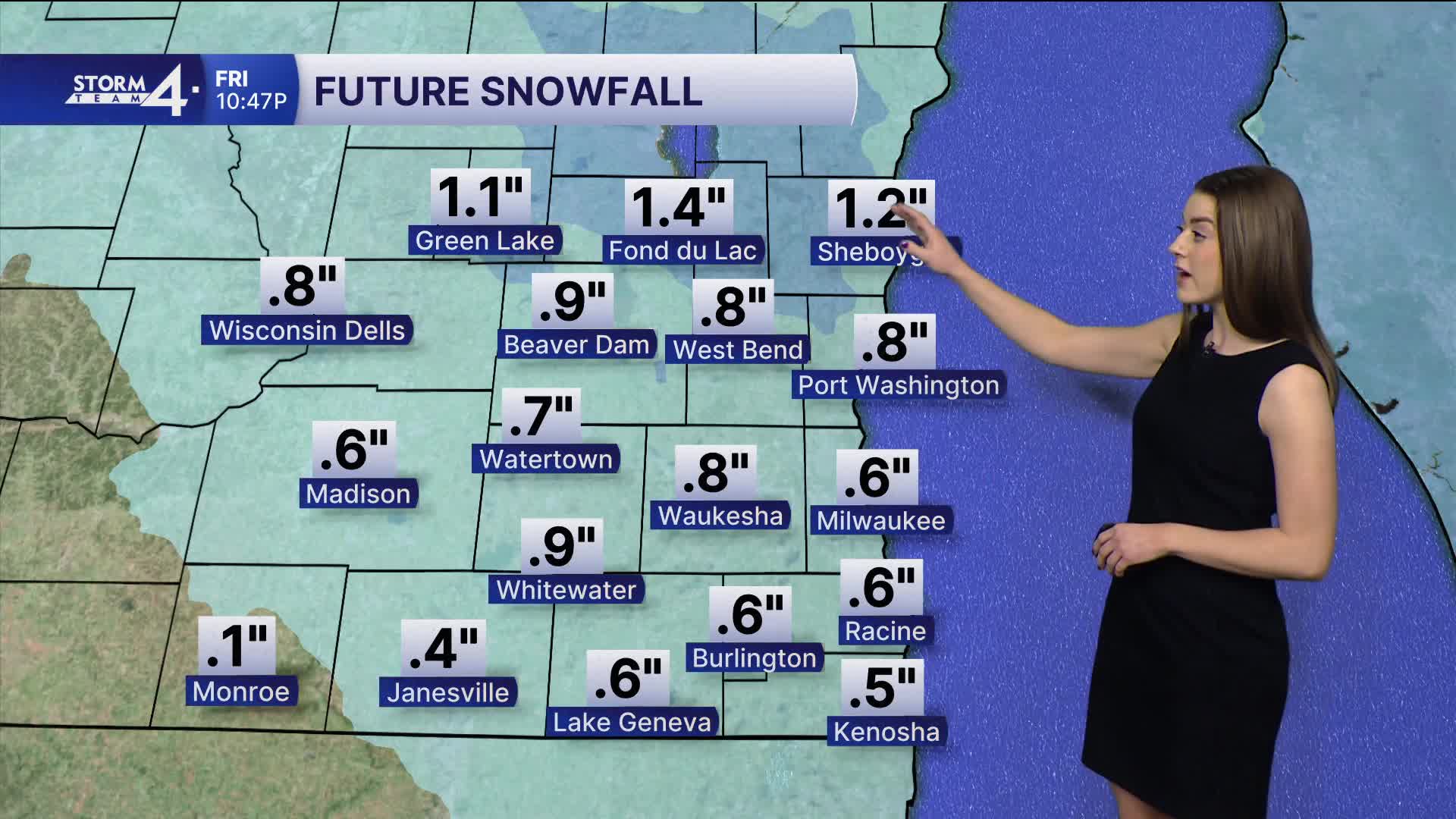
Watch: How much snow to expect
Another round of snow is also on the way later tonight. Snow should spread across SE Wisconsin after midnight and will continue into early tomorrow morning.
Around an inch of snow is expected, with some higher amounts possible northwest of Milwaukee.
This will be a wetter/heavier variety of snow.
TONIGHT: Snow/Mix Late. Around 1" Likely
Lows: 28
Wind: W 5 mph
FRIDAY: Early AM Mix. Partly Cloudy and Breezy
High: 35
Wind: N 10-20 mph
SATURDAY: Partly Cloudy with Ch. Light Snow Late
High: 20
SUNDAY: Partly Cloudy
High: 32
MONDAY: Mostly Cloudy and Mild
High: 37
It’s about time to watch on your time. Stream local news and weather 24/7 by searching for “TMJ4” on your device.
Available for download on Roku, Apple TV, Amazon Fire TV, and more.
