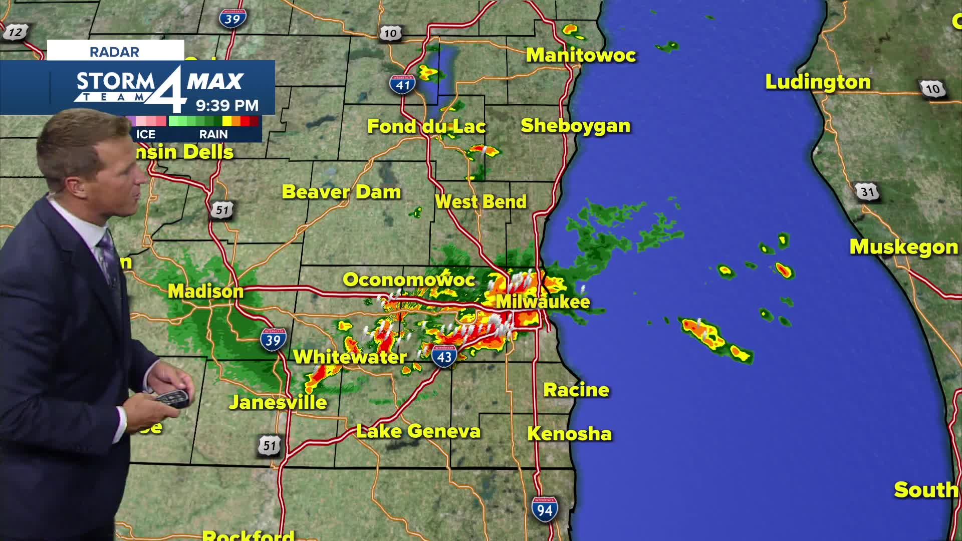


Warmth, humidity, and a slowly progressing frontal boundary draped across the state have produced more thunderstorms today, and more will likely be on the way this evening.
A stray shower or storm is possible early this evening, with a better chance for storms developing after 8 p.m. A few of these storms may be strong to severe, but we aren't expecting widespread severe weather.
The last potential round of showers and storms with this front may fire up around midday tomorrow.
Watch: When you'll need the umbrella
Another slow-moving area of low pressure will track to our south for the rest of the week. We'll keep a slight chance for showers in the forecast, but the bulk of the precipitation should also bypass us to the south.
TONIGHT: Ch. Showers/Storms Early and Still Muggy
Low: 64
Wind: S 5 mph
TUESDAY: Partly Cloudy and Still Humid. Ch. Showers
High: 75
Wind: S to NE 5-10 mph
WEDNESDAY: Partly Cloudy. Slight Ch. Showers
High: 71
THURSDAY: Partly Cloudy. Slight Ch. Showers
High: 73
FRIDAY: Partly Cloudy and Warm
High: 77
It’s about time to watch on your time. Stream local news and weather 24/7 by searching for “TMJ4” on your device.
Available for download on Roku, Apple TV, Amazon Fire TV, and more.
