

We were one degree away from experiencing an official pneumonia front this afternoon. The temperatures dropped 15 degrees between 2:05 p.m. and 3:05 p.m. It will remain cooler and breezy this evening, along with some scattered showers.
The on and off showers continue tonight and into tomorrow morning. Only up to 0.25" of rain is expected.
Watch: When lows could fall into the 50s
More seasonal weather will be with us the rest of the week, but the return of high pressure also means more sunshine and beautiful fall conditions.
We may climb back up to around 70 this weekend!
TONIGHT: Showers Likely. Less Than 0.25" Rain
Low: 55
Wind: N 5-10 mph
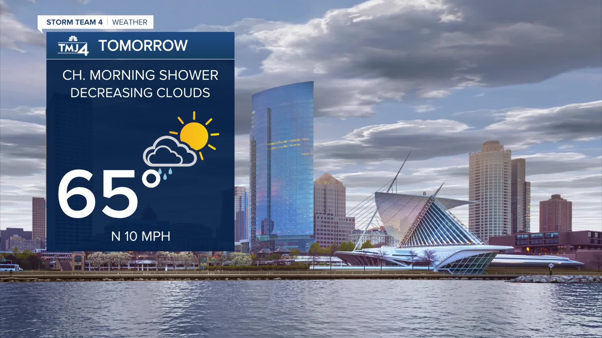
TOMORROW: Ch. Morning Showers. Dec. Clouds
High: 65
Wind: N 10 mph
WEDS: Mostly Sunny and Cool
High: 60
THUR: Mostly Sunny
High: 64
FRIDAY: Ch. Shower Early and Partly Cloudy
High: 66
It’s about time to watch on your time. Stream local news and weather 24/7 by searching for “TMJ4” on your device.
Available for download on Roku, Apple TV, Amazon Fire TV, and more.
