

The beat goes on with another beautiful evening in Southeast Wisconsin. Skies remain mainly clear tonight with lows around 60 degrees!
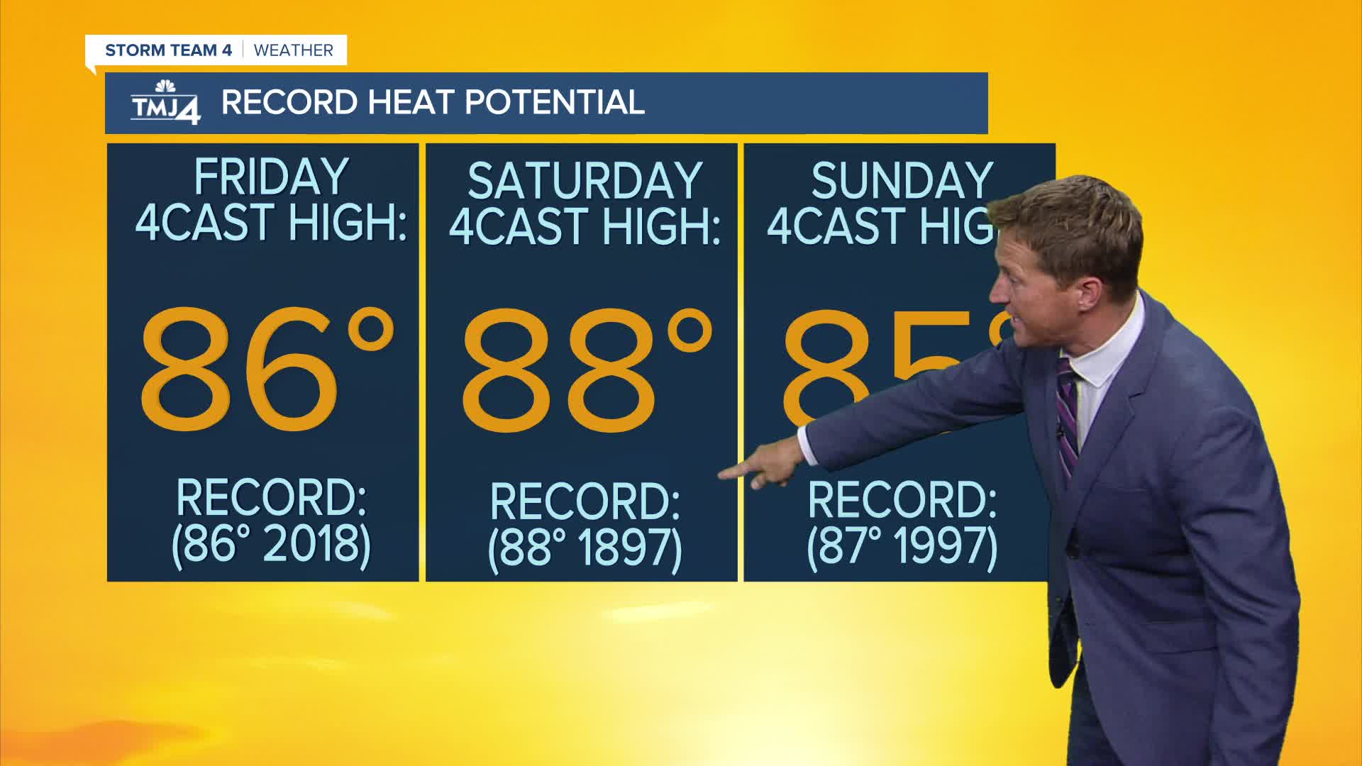
Bring on the heat starting tomorrow. We have a chance of reaching record high temperatures Friday, Saturday, and Sunday as we top out in the mid to upper 80s each day. If we have completely sunny skies and the southwest breeze holds any cooling near the lake, there is an outside chance of reaching 90 degrees in Milwaukee. This would be our first 90-degree October temperature on record. The best odds of achieving this would be Saturday.
Watch: Watching for near-record heat this weekend
A cold front brings a good chance for rain Monday through Tuesday morning, along with more seasonal temperatures.
TONIGHT: Mainly Clear and Mild
Low: 63
Wind: SE 5 mph
FRIDAY: Sunny and Very Warm
High: 86
Wind W to N 5-10 mph
SATURDAY: Mostly sunny, Very Warm, and Humid.
High: 88
SUNDAY: Partly Cloudy and Still Very Warm and Humid
High: 85
MONDAY: Mostly Cloudy with Rain Likely
High: 72
It’s about time to watch on your time. Stream local news and weather 24/7 by searching for “TMJ4” on your device.
Available for download on Roku, Apple TV, Amazon Fire TV, and more.
