

We still can't rule out a stray shower or sprinkle this evening, but most of the area should be dry.
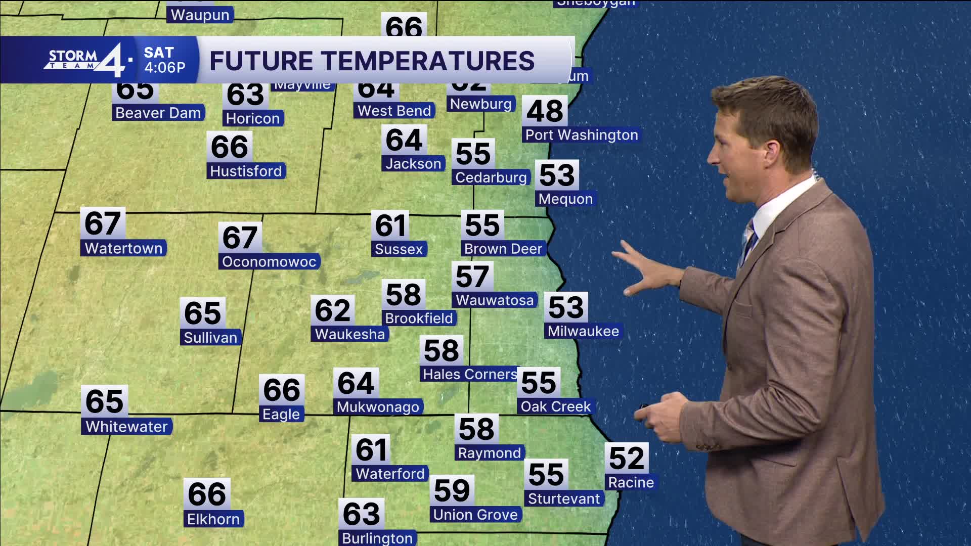
A nice spring weekend is on the way! You can expect sunshine both Saturday and Sunday with high temperatures ranging from the 50s lakeside to the 60s inland.
WATCH: Will there be a potential for showers/storms next Monday?
We're keeping an eye on the return of rain and storms on Monday. Any severe weather will depend on the northern extent of a warm front that likely drapes itself across southern Wisconsin.
Cooler weather is in the cards for the second half of next week.
TONIGHT: Mostly Cloudy
Lows: 45
Wind: N 5-10 mph
SATURDAY: Mostly Sunny
High: 58 Lake 65 Inland
Wind: NE 10 mph
SUNDAY: Mostly Sunny
High: 58 Lake 66 Inland
MONDAY: PM Rain/Storms
High: 60 Lake 66 Inland
TUESDAY: Parlty Cloudy
High: 54
It’s about time to watch on your time. Stream local news and weather 24/7 by searching for “TMJ4” on your device.
Available for download on Roku, Apple TV, Amazon Fire TV, and more.
