

Our high temperatures made it to the mid 50s today! Believe it or not, this wasn't our warmest day of 2026! We hit 59 degrees on January 9.
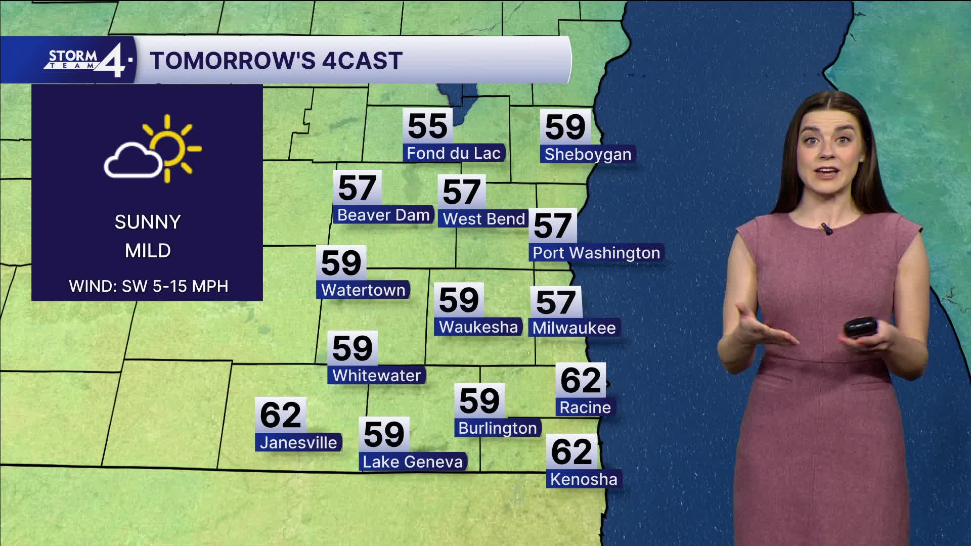
The 50s stick around! Monday will look and feel similar to Sunday. We can expect high temperatures in the mid to upper 50s. With sunny skies, warm temperatures, and mild winds, we can expect it to feel pleasant!
Watch: When we can expect temperatures to fall back to freezing.
High pressure will break down the middle of the week, and we'll see a series of storm systems sweep up and across the state. The first round of rain will move in Tuesday evening. It looks like mainly rain for us. As it moves to Northern Wisconsin, we will see more warm air here. Highs are back in the mid-50s on Wednesday.
Thursday will be our second weather system of the week. Temperatures will be cooler and closer to normal as we fall into the 30s. Now we are watching rain/snow mix Thursday and Friday.
Next weekend will be cloudy and average with temperatures in the 30s.
Enjoy the 50s while we have them!
SATURDAY NIGHT: Few Clouds
Lows: 32
Wind: SW 5 mph
SUNDAY: Mostly Sunny and Mild
High: 51 Lake 56 Inland
Wind: W 5 mph
MONDAY: Mostly Sunny and Mild
High: 57
TUESDAY: Increasing Clouds with Ch. Rain Showers At Night
High: 50
WEDNESDAY: Chance Rain
High: 50
THURSDAY: Chance Mix
High: 43
It’s about time to watch on your time. Stream local news and weather 24/7 by searching for “TMJ4” on your device.
Available for download on Roku, Apple TV, Amazon Fire TV, and more.
