

The 50-degree temperatures last week seem like a distant memory.
January is in full swing here in Southeast Wisconsin.
Sunday is the fifth day in a row that have seen accumulating snow.
You can expect snow showers and breezy winds Sunday evening and overnight. The National Weather Service has issued a winter weather advisory for all of Southeast Wisconsin from 6 p.m. Sunday to noon on Monday. Expect accumulations near 1 inch.
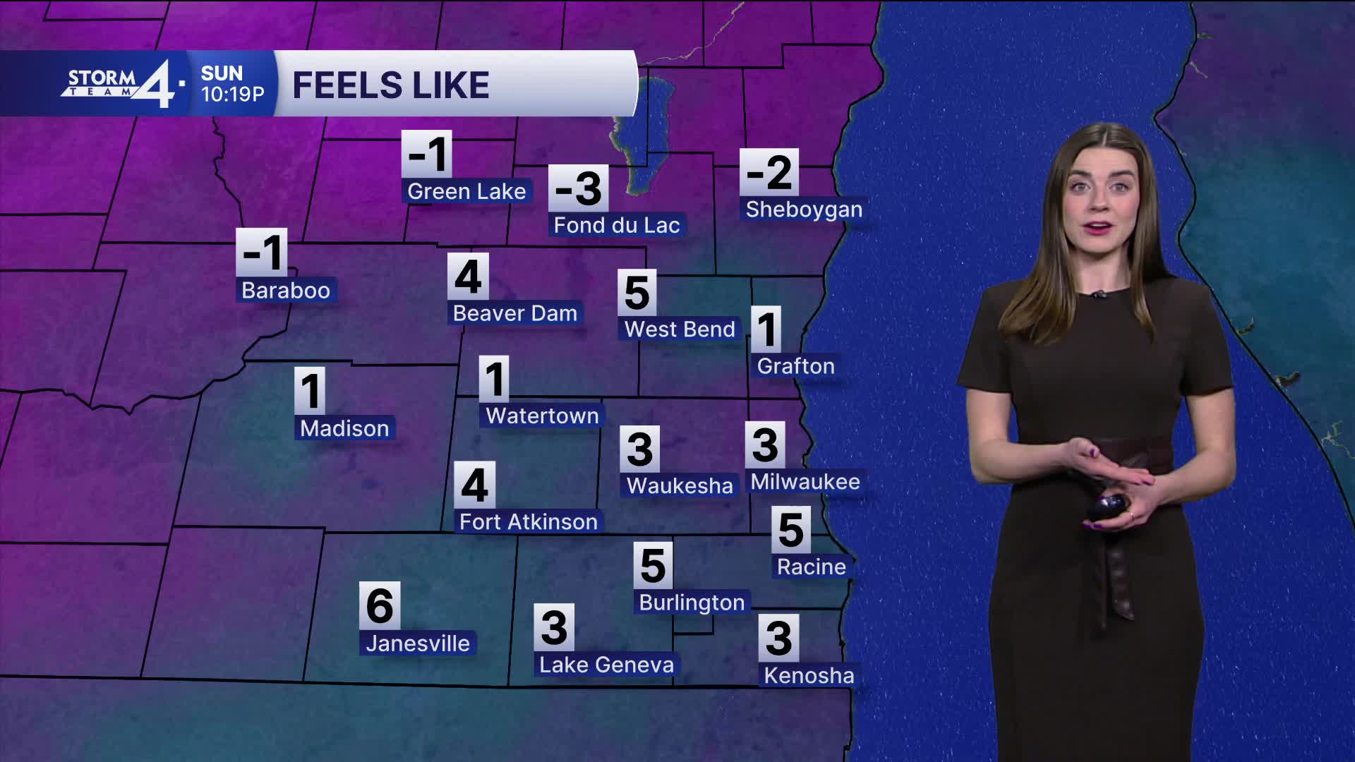
On Sunday night, we also have a Cold Weather Advisory in effect.
This is for wind chill temperatures reaching -25 degrees. This advisory is in effect from 3 a.m. to noon on Monday. Not only will it get very cold overnight, but it's also going to be extremely windy with westerly wind gusts reaching 40 mph.
Watch: Why the next week could be one of the coldest of the year here in Southeast Wisconsin.
Monday's high temperatures are only going to be in the single digits, but with the strong wind, it's going to feel like it's -10 to -25.
We will see more sunshine and a bit more warmth on Tuesday.
Highs make it to the teens. Tuesday night into Wednesday another clipper will brush through Wisconsin. This brings us another good chance of a minor snow event.
Overall, it's going to be a cold week with highs in the teens to low 20s and another bitter shot of air possible next weekend with highs only in the single digits.
This is climatologically the coldest week of the year.
***ALL OF SOUTHEAST WISCONSIN: COLD WEATHER ADVISORY FROM 3 A.M. UNTIL NOON MONDAY***
***ALL OF SOUTHEAST WISCONSIN: WINTER WEATHER ADVISORY FROM 6 P.M. SUNDAY UNTIL NOON MONDAY***
SUNDAY NIGHT: Bitter Cold
Low: 0
Wind: W 10-15 mph
MONDAY: Very Cold & Windy
High: 8
Wind: NW 15-25 G40
Wind Chill: -10 to -25
TUESDAY: Mostly Sunny
High: 16
Winds: W 5-15 mph
WEDNESDAY: Morning Snow, Mostly Cloudy
High: 22
THURSDAY: Partly Sunny
High: 18
FRIDAY: Mostly Cloudy
High: 15
It’s about time to watch on your time. Stream local news and weather 24/7 by searching for “TMJ4” on your device.
Available for download on Roku, Apple TV, Amazon Fire TV, and more.
