

Showers and storms are popping up again this afternoon.
No severe weather is expected but along with a little bit of thunder and lightning, there will be some heavy downpours. Hit and miss showers and storms will continue overnight.
A few showers are possible again on Sunday, especially in the morning. Sunday's showers should be even more scattered than Saturday's.
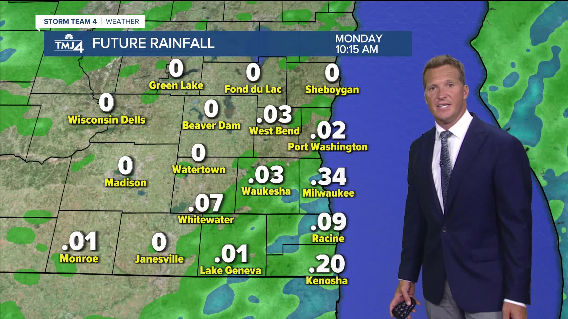
Our weather pattern remains unsettled to start the work week. Another potential round of showers and storms arrive Monday afternoon.
There is quite a bit of uncertainty how the rest of the week plays out. Some computer model runs indicate an area of low pressure closed off from the jet stream, which would mean lingering chances for showers through the week.
Other computer model runs build an area of high pressure, which means we dry out starting Tuesday. For now it's a wait and see.
WATCH: Southeast Wisconsin weather: Scattered Weekend Showers and Storms
SATURDAY NIGHT: Widely Scattered Showers and T-Storms
Low: 63
Wind: SE 5 mph
SUNDAY: Chance Showers, Mainly Early. Partly Cloudy and Humid
High: 78
Wind: S 5-10 mph
MONDAY: Partly Cloudy. Chance of Showers/Storms Late
Highs: 78
TUESDAY: Partly Cloudy. Slight Chance of Showers
High: 72
WEDNESDAY: Partly Cloudy. Slight Chance of Showers
High: 72
It’s about time to watch on your time. Stream local news and weather 24/7 by searching for “TMJ4” on your device.
Available for download on Roku, Apple TV, Amazon Fire TV, and more.
