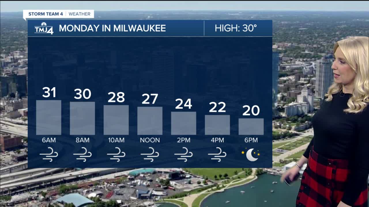


Wind will be the big story Monday. Gusts up to 55 mph are possible, which could blow around unsecured objects and take down tree branches. A Wind Advisory will be in place from 3 am to 3 pm Monday. A few snow flurries are possible in the morning, with some clearing by afternoon. High temperatures Monday will happen in the morning, with a steady drop in the temperatures throughout the day. We will go from the low 30s early in the day, to the 20s mid-day, and teens by evening.
Tuesday morning will be the coldest morning of the season with lows in the single digits for most of SE Wisconsin. Tuesday afternoon highs only rebound into the low 20s. A few light snow showers are possible Tuesday night.
Wednesday is partly to mostly cloudy with highs in the low 30s. Thursday we expect to see a mix of rain and snow showers and gusty winds.
MONDAY: Morning flurries. Partly to mostly cloudy. Very windy.
High: 30
Wind: NW 15-30 G55 mph
TUESDAY: Very cold, partly cloudy, light PM Snow
High: 22
WEDNESDAY: Mostly cloudy
High: 32
THURSDAY: Rain and snow mix, breezy
High: 39
FRIDAY: Chance mix
High: 43
