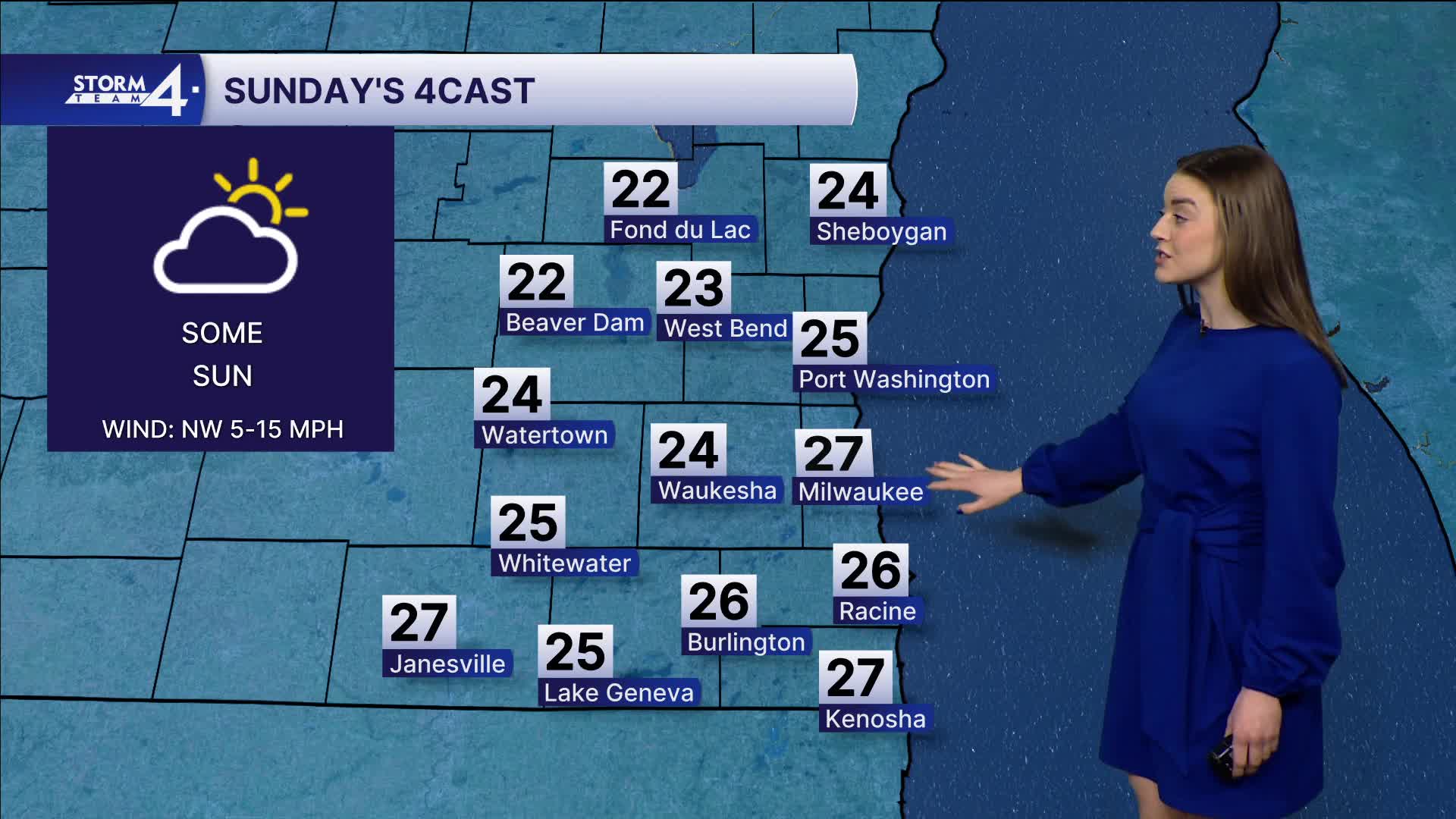


It was another day in the 20s across Southeast Wisconsin.
After all, it is still February. Our average high temperature is in the 30s.
Sunday night, we will see a few more flurries.
The light snow chances end before the sun comes up Monday. Very little or no snow accumulation is expected.
High temperatures on Monday stay in the upper 20s which will make for 3 days below normal.
Watch: Could we see accumulating snow this week?
Storm Team 4 is monitoring a couple storm systems that may come into play the middle of next week with some accumulating snow potential.
Our first snow chance comes Tuesday afternoon as an area of low pressure passes through Wisconsin.
Next weekend appears to be warmer with temperatures in the 40s and some sun!
SUNDAY NIGHT: Partly Cloudy and Few Flakes Possible
Low: 15
Wind: NW 10-20 mph
MONDAY: Partly Cloudy and Breezy
High: 27
Wind: NW 5-15 mph
TUESDAY: Ch. Light Snow
High: 37
Wind: S 10-20
WEDNESDAY: Partly Cloudy, Chance Mix
High: 32
THURSDAY: Mostly Cloudy, Chance Mix
High: 36
FRIDAY: Mostly Sunny
High: 45
It’s about time to watch on your time. Stream local news and weather 24/7 by searching for “TMJ4” on your device.
Available for download on Roku, Apple TV, Amazon Fire TV, and more.
