

It was another typical Spring day.
We had more clouds Sunday. This came with cooler temperatures near the lake, but springlike warmth inland. Tonight we will see mostly cloudy skies and temperatures in the mid 40s.
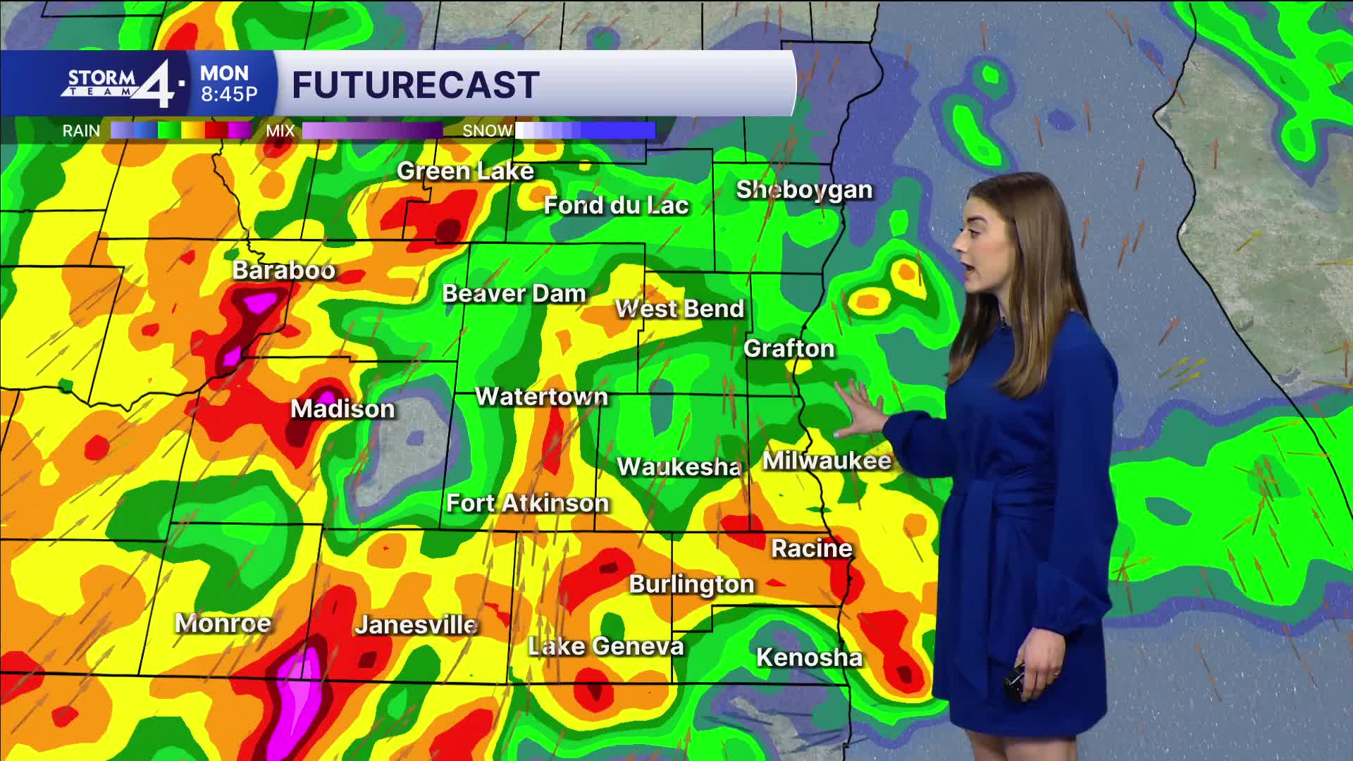
Storm Team 4 is tracking an area of low pressure moving towards Wisconsin. This will bring us our next round of rain and storms. There is a chance we will see showers Monday morning; these will not be severe.
Watch: What the severe weather risk looks like on Monday in Southeast Wisconsin.
The chance for severe weather is more likely Monday evening and is dependent on how far north a warm front can reach as well as some daytime sunshine. If strong storms are allowed to develop, all severe impacts are possible. Most of Southeast Wisconsin is included in a slight risk which is a level 2 of 5.
After the storms, the rest of your week is dry.
Our average high temperature is 57 this week. Our highs are slightly below average this week.
SUNDAY NIGHT: Mostly cloudy
Low: 45
Wind: E 5-10 mph
MONDAY: PM rain/storms; some severe
High: 64
Wind: SE 10-20 mph
TUESDAY: Partly cloudy
High: 60
Wind: W 10-15
WEDNESDAY: Partly cloudy
High: 55
THURSDAY: Partly cloudy
High: 53
FRIDAY: Mostly cloudy
High: 52
It’s about time to watch on your time. Stream local news and weather 24/7 by searching for “TMJ4” on your device.
Available for download on Roku, Apple TV, Amazon Fire TV, and more.
