

It was another chilly start this morning. Most of Southeast Wisconsin fell into the in the low 40s with a few places in the 30s. It's time to put the fall air on pause for a few days. It's warming up this week! Thanks to sunshine and southerly winds, our highs were in the low 70s today!
Tuesday won't be quite as sunny. Expect more clouds on Tuesday night, with a slight chance of showers. Highs in the mid-70s.
We will see highs in the mid-70s and a mix of sun and clouds on Wednesday and Thursday.
Watch: Will we get back to 80 degrees before fall?
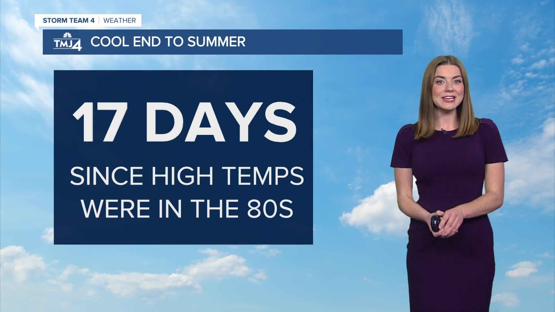
It has been more than 2 weeks since we were in the 80s. Eighty degrees is possible for Friday and Saturday! It is also during this time we may run into a stray shower or storm. Stay with Storm Team 4 as we get closer!
TONIGHT:
Lows: 53
Wind: S 5-10 mph
TUES: Clouds increase, rain possible overnight
High: 74
Wind: S 5-10 mph
WED: Mostly Sunny
High: 75
Wind: S 5 mph
THUR: Mostly Sunny
High: 78
FRI: Mostly Sunny
High: 78
SAT: Chance for Showers
High: 80
It’s about time to watch on your time. Stream local news and weather 24/7 by searching for “TMJ4” on your device.
Available for download on Roku, Apple TV, Amazon Fire TV, and more.
