

We have been in the 80s for the past three days. Thankfully it hasn't been too humid.
The sunny skies, warm temperatures and lack of rain have made it feel like a perfect summer weekend. Unfortunately (or maybe fortunately) the summer weather ends Sunday.
A cold front is working its way through Wisconsin. This will bring a good chance for rain Monday through Tuesday morning along with more seasonal temperatures.
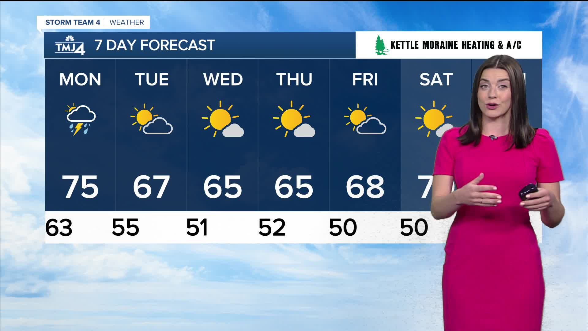
We will see highs in the mid 70s on Monday. Cloudy skies will bring scattered showers and some thunder to SE Wisconsin. Most of the area will collect 0.25-0.5 inches of rain.
Expect those high temperatures to drop to the 60s by the middle of the week.
We are still a few weeks away from peak fall colors.
WATCH: Southeast Wisconsin weather: One More Warm Day, then Changes Monday
SUNDAY NIGHT: Clouds Increase
Low: 65
Wind: S 10 mph
MONDAY: Mostly Cloudy with Showers Likely
High: 75
Wind: W 5-15 mph
TUESDAY: Rain Early then Decreasing Clouds
High: 66
Wind: N 5-10 mph
WEDNESDAY: Mostly Sunny, Normal Temps.
High: 65
THURSDAY: Mostly Sunny, Normal Temps.
High: 65
FRIDAY: Partly Cloudy
High: 68
It’s about time to watch on your time. Stream local news and weather 24/7 by searching for “TMJ4” on your device.
Available for download on Roku, Apple TV, Amazon Fire TV, and more.
