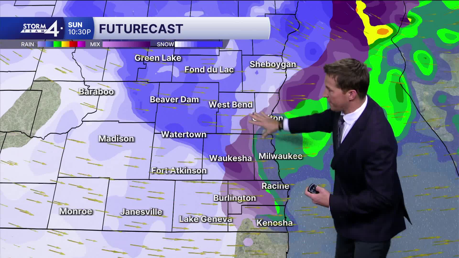


It's been a soggy and gross day to say the least. The rain eventually changes to snow from the west to the east through the evening as temperatures drop into the 20s.
Everyone should be all snow by midnight.
The wind also ramps up with gusts approaching 50 mph by early tomorrow morning. Travel will become slippery and difficult across all of southeast Wisconsin.
Watch: When we could see snow return to Southeast Wisconsin.
The worst conditions will be across Sheboygan and Fond du Lac counties, where as much as 6" of snow is possible. The Metro Milwaukee area can expect 1-2" of snow. The snow ends tomorrow morning, but we'll continue to see a lot of blowing snow in the countryside. Winter has returned.
*****WINTER STORM WARNING FROM 6PM THIS EVENING UNTIL 6PM MONDAY FOR FOND DU LAC AND SHEBOYGAN COUNTIES****
*****WINTER WEATHER ADVISORY FROM 6PM THIS EVENING UNTIL 6PM MONDAY FOR OZAUKEE, WASHINGTON, DODGE, JEFFERSON, AND WAUKESHA COUNTIES***
****WIND ADVISORY FROM 6PM THIS EVENING UNTIL 6PM MONDAY FOR ALL OF SE WISCONSIN***
TONIGHT: Very Windy with Rain to Snow. 1-2" Milwaukee 4-6" Far North
Low: 23
Wind: W 20-30 G 50 mph
MONDAY: Snow Early, Windy, with Blowing Snow.
High: 26
Wind: W 20-30 G 45 mph
TUESDAY: Windy with PM Snow Showers Likely
High: 27
Wind: NW 20-30 mph G 45 mph
WEDNESDAY: Windy with Ch. Snow Showers
High: 24
THURSDAY: Mostly Sunny, Windy, and Very Cold
High: 15
It’s about time to watch on your time. Stream local news and weather 24/7 by searching for “TMJ4” on your device.
Available for download on Roku, Apple TV, Amazon Fire TV, and more.
