

Dense fog has set in across southern Wisconsin following a lake breeze last night. Visibility drops below 1 mile are common across the area. As winds pick up, the fog will mix out by late morning. Highs climb into the upper 60s lakeside and mid-70s farther inland. Sunshine will give way to more cloud cover as storms move in from the West.
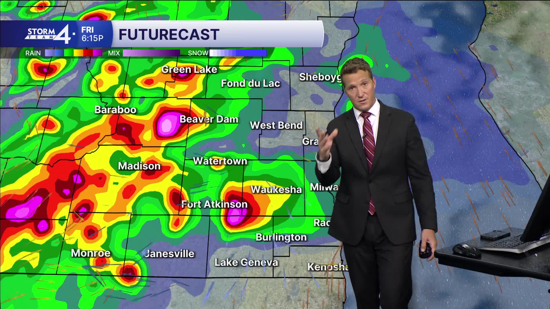
Storm Team 4 is monitoring another severe weather threat for southeastern Wisconsin. Showers and storms will move in from the West this evening. The strongest storms may contain damaging winds, hail and torrential downpours. As the storms move East, they are expected to weaken and leave a more favorable area for tornadic development. As a result, the tornado threat is lower for Milwaukee.
WATCH: Dense fog has set in across southern Wisconsin following a lake breeze last night
Hi-res models suggest 1-2" of rainfall is the most persistent storms. This will almost certainly create flooding conditions wherever it occurs. A Flood Watch is in place for the entire area from 1P - 7A Saturday. Please use extreme caution near rivers and avoid flooded roadways.
Thankfully, an extended period of dry weather follows tonight's storms. Highs will fall into the upper 40s and lower 50s this weekend. The 60s return next week.
FRIDAY: AM fog; partly cloudy, storms at night
High: 68 Lake 76 Inland
Wind: SE 5-15 G 25 mph
FRIDAY NIGHT: Showers/storms; mostly cloudy
Low: 42
Wind: S/W 10-15 mph
SATURDAY: Rain ends, mostly sunny
High: 50
Winds: W 10-15 G 25 mph
SUNDAY: Mostly sunny and cool
High: 47
MONDAY: Mostly sunny
High: 50
TUESDAY: Partly cloudy
High: 68
It’s about time to watch on your time. Stream local news and weather 24/7 by searching for “TMJ4” on your device.
Available for download on Roku, Apple TV, Amazon Fire TV, and more.
