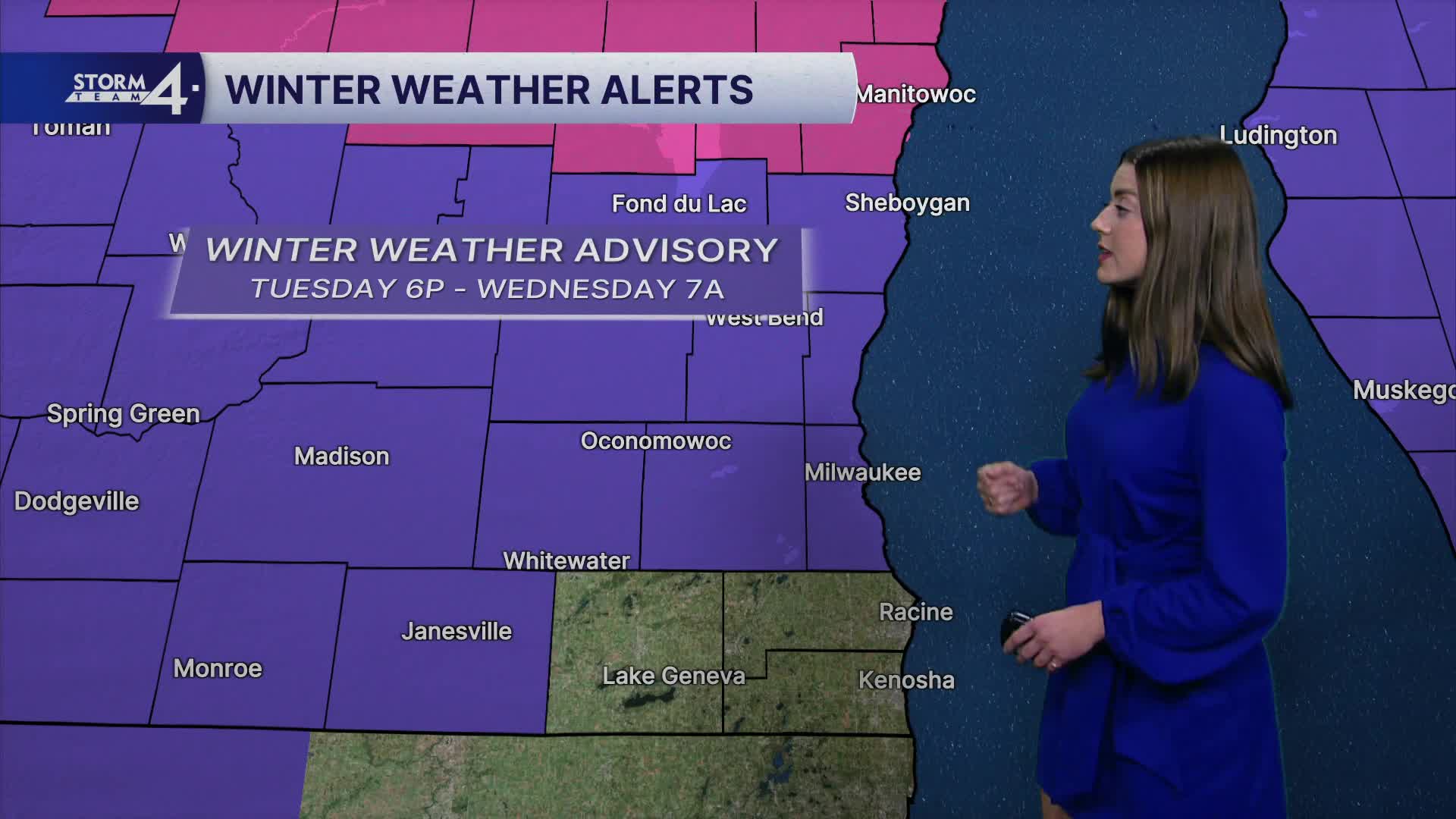


A Winter Weather Advisory will be in effect from 9:09 p.m. Tuesday until 9 a.m. Wednesday for Milwaukee, Waukesha, Washington, Ozaukee and Sheboygan Counties.
A Winter Weather Advisory will be in effect from 9:09 p.m. Tuesday until 7 a.m. Wednesday for Fond du Lac, Dodge and Jefferson Counties.
A rain/snow line bears watching this evening and overnight. Rain/freezing rain is more likely near & South of I-94. The Milwaukee metro area will be a transition zone from rain to snow. Almost all snow is expected farther North of I-94. This is where snowfall accumulations may reach up to 3". Some places in northern FDL/Sheboygan counties may see a bit more.
Watch: When a wintry mix spreads over the area
Expect a messy Tuesday evening commute. Southerly winds will continue overnight and into Wednesday. As the low-pressure system moves through southern Wisconsin, a lull in precipitation is expected around midnight. Cold air flows on the backside of the departing system. A few snow showers will pick up just before morning and be around for the Wednesday morning commute. Please be aware that some roads/sidewalks/parking lots may become icy & slippery due to rain falling on frozen ground.
While temperatures may top out in the mid-30s early Wednesday, the thermometer will fall throughout the day. Temperatures will be in the 20s by 5P.
Overnight lows crash into the single digits and teens first thing Thursday. A cold stretch of weather is expected into the weekend. A few passing flurries are possible on Friday and again on Saturday. Another cold snap is anticipated over the weekend. Overnight lows could dip below zero while highs may barely exit the single digits.
High temperatures are back down to the teens with lows approaching 0 degrees for the weekend.
TONIGHT: Rain/Snow Mix
Low: 30
Wind: S 10-20 G 30 mph
WEDNESDAY: Early Snow; Falling Temperatures
High: 34; Falling to 25 by 5P
Wind: NW 15-25 mph
THURSDAY: Mostly Sunny
High: 21
Wind: W 5-10 mph
FRIDAY: Chance Snow
High: 25
SATURDAY: Chance Flurry; Very Cold
High: 10
SUNDAY: Mostly Sunny
High: 10
It’s about time to watch on your time. Stream local news and weather 24/7 by searching for “TMJ4” on your device.
Available for download on Roku, Apple TV, Amazon Fire TV, and more.
