

Northeast Wisconsin is under a Winter Weather Advisory and anticipating a few inches of snow today. We are not included in this. Most of this system will stay north of us. However, warmer air makes this forecast a bit more complicated.
A weak system will be rolling through with a light wintry mix or freezing drizzle. The farther you live to the north, the better your chance of seeing this precipitation. There could be a few slick spots by Monday morning, but treated surfaces will be fine. Lows won't be as cold, temps stay in the mid 20s.
Watch: When temperatures will warm back up
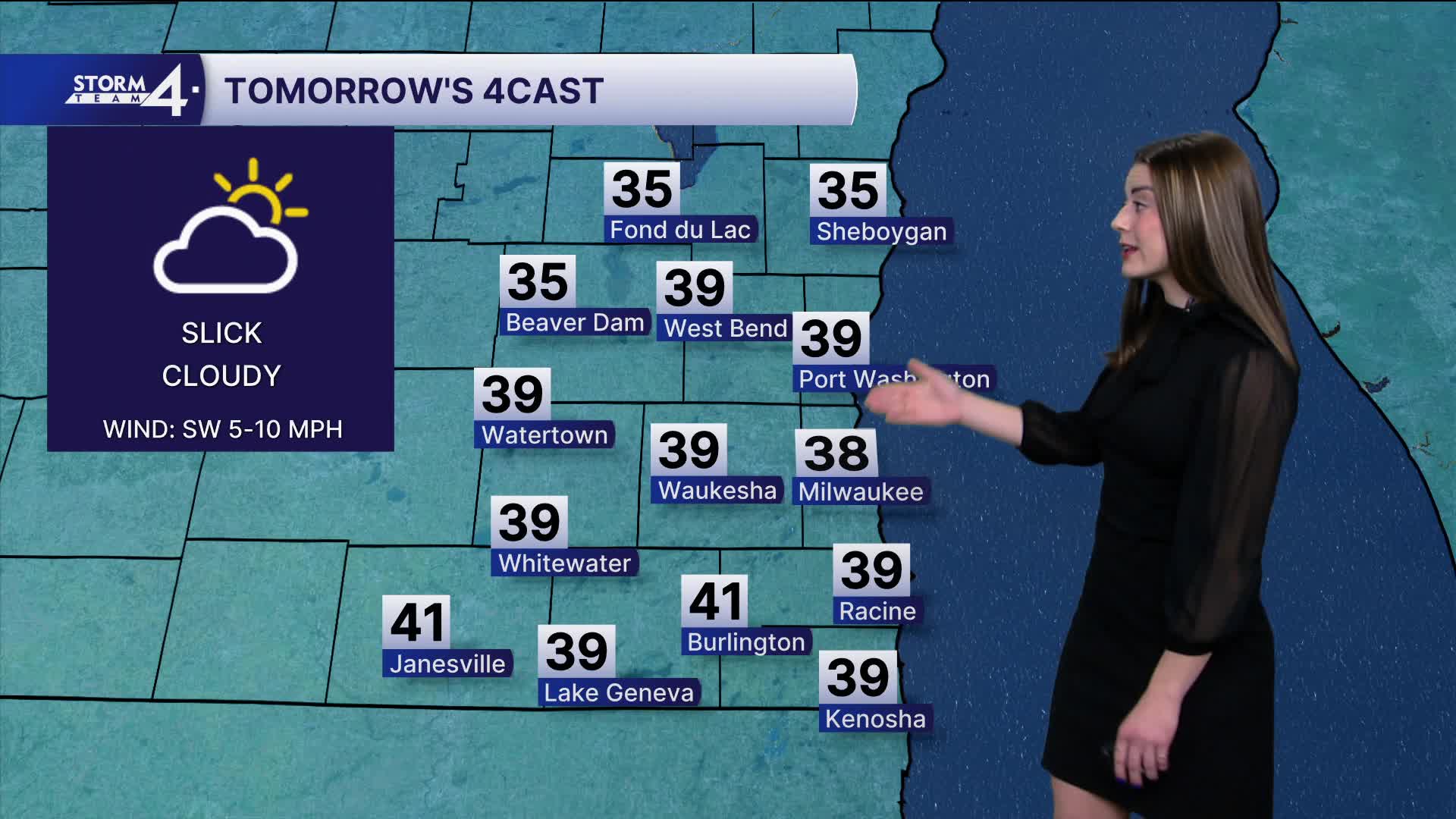
Here comes the mild temps! Highs will pop above freezing in the upper 30s for Monday. Skies remain cloudy. We could see some rain showers Monday night to Tuesday morning. Temperatures stay in the 40s for the work week.
Conditions are closer to normal with some rain into the weekend but still above average!
Average high is 32 degrees for this time of year.
TONIGHT: Mixed Precip, Patchy Freezing Drizzle
Low: 24
Wind: S 5-10 mph
MONDAY: Cloudy
High: 38
Wind: SW 5-10 mph
TUESDAY: AM Rain
High: 41
WEDNESDAY: Mostly Sunny
High: 43
THURSDAY: Mostly Cloudy
High: 44
Friday: Chance rain showers
High: 40
It’s about time to watch on your time. Stream local news and weather 24/7 by searching for “TMJ4” on your device.
Available for download on Roku, Apple TV, Amazon Fire TV, and more.
