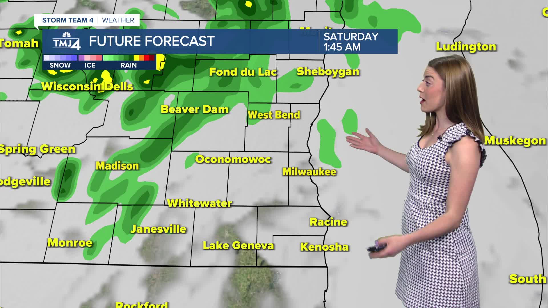


A cluster of showers/storms will roll into the region early Saturday morning. While severe weather is not expected, gusty winds are possible in the strongest storms that can develop.
The best chance of rain is during the mid-late morning period. Showers will be fairly fast-moving. Even though the day is not a complete washout, the extra cloud cover and timing may prevent maximum daytime heating.
High temperatures in Milwaukee may struggle to reach 80 and have been adjusted downward to account for the rain/cloud cover.
Watch: When we could see some rain chances
Sunshine returns later on Sunday, bringing our temperatures into the mid-70s along the lake and mid-80s inland.
The next work week will be sunny and summery, as sunshine and heat continue.
TONIGHT: Chance Showers/Storms; Mostly Cloudy
Low: 63
Wind: SE 5-10 mph
SATURDAY: Chance Showers/Storms; Mostly Cloudy
High: 77
Wind: SE 10-20
SUNDAY: Sunny, Warmer Inland
High: 76
Wind: NE 5-10
MONDAY: Mostly Sunny, Warmer Inland
High: 77
TUESDAY: Mostly Sunny
High: 80
WEDNESDAY: Mostly Sunny
High: 80
It’s about time to watch on your time. Stream local news and weather 24/7 by searching for “TMJ4” on your device.
Available for download on Roku, Apple TV, Amazon Fire TV, and more.
