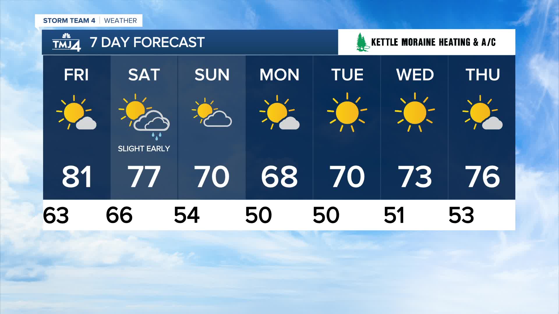


It's been near perfection today with sunshine and temperatures in the 70s! It'll be a quiet and comfortable night tonight. This may be a great opportunity to open up the windows before temperatures bounce back up to 80 Friday afternoon.
Watch: Fall-like weather is moving in:
A stronger colder front is still on the way Saturday morning. A few brief showers may develop ahead of the front late Friday night and into Saturday morning.
We'll still reach the middle to upper 70s on Saturday, but much of the area may not get out of the 60s on Sunday and Monday. Low temperatures will likely dip into the 40s Sunday night and Monday night. This will be our first brush with fall.
THURSDAY: Mostly Sunny
High: 75
Wind: NE 5-10 mph
TONIGHT: Mainly Clear
Low: 63
Wind: NE 5 mph
FRIDAY: Mostly Sunny
High: 80
SATURDAY: Slight Chance AM Shower; Mostly Sunny & Breezy
High: 78
SUNDAY: Mostly Sunny & Breezy
High: 71
MONDAY: Slight Chance AM Shower; Mostly Sunny
High: 68
It’s about time to watch on your time. Stream local news and weather 24/7 by searching for “TMJ4” on your device.
Available for download on Roku, Apple TV, Amazon Fire TV, and more.
