


We saw some scattered rain showers this morning. I have yet to see a report of more than ¼ inch of rain. Friday afternoon, we are back to mostly sunny skies! This weekend will look and feel like October!
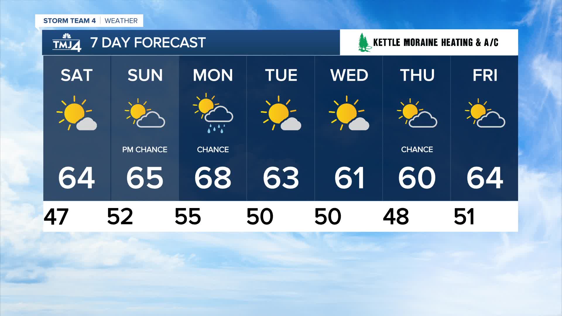
Sunshine is expected on Saturday with highs in the mid-60s.
This is perfect for pumpkin patches, apple orchards, and tailgating at American Family Field. By the end of the Brewers game, temperatures will sit around 50 degrees.
Watch: How long the nice weather lasts
Sunshine sticks around for Sunday, again with highs in the 60s.
The next chance of rain arrives late Sunday night into Monday as a weak cold front drops through the Badger State. Average temperatures are expected through mid-next week.
TONIGHT: Partly Cloudy
Low: 50
Wind: NW 5-10 mph
SATURDAY: Mostly Sunny
High: 63
Wind: NE 5-10 mph
SUNDAY: Mostly Sunny; Chance PM Rain
High: 64
MONDAY: Slight Chance Showers; Partly Sunny
High: 68
TUESDAY: Mostly Sunny
High: 63
WEDNESDAY: Partly Cloudy
High: 61
It’s about time to watch on your time. Stream local news and weather 24/7 by searching for “TMJ4” on your device.
Available for download on Roku, Apple TV, Amazon Fire TV, and more.
