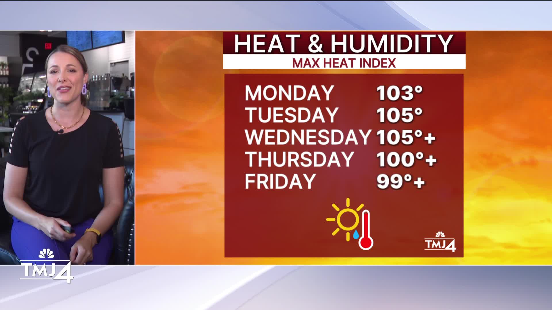


Happy last day of June! Our extreme heat warning was extended another day. It is now in effect until 7 p.m. Wednesday. Heat index values will again top 100. Skies will be mostly sunny.
WATCH: when rain could bring relief in your Storm Team 4Cast
Some storm chances are possible in north and central Wisconsin on Wednesday but will provide little relief. Rain chances will increase at the end of the week, with temperatures returning to the upper 80s for the weekend.
The Fourth of July has storm chances, so stay tuned for updates as we get closer.
TODAY: Extreme Heat warning in effect. Heat index over 105 in some spots. Sunny.
High: 95
Wind: SW 10-15 G25
TONIGHT: Very muggy and mostly clear. Slight chance of storms north.
Low: 77
Wind: SW 10-15
WEDNESDAY: Mostly sunny. Hot and humid. Extreme heat warning in effect until 7pm.
Tracking a few storms near Fondy and Sheboygan (along with central WI) AM and PM with a stalled front.
High: 96
THURSDAY: Hot and humid. Sl. chance of showers
High: 93
FRIDAY: Hot and muggy. Another shot at storms north.
High: 90
SATURDAY: Partly cloudy, muggy, with storm chances.
High: 87
SUNDAY: Storm likely. Muggy still.
High: 82
It’s about time to watch on your time. Stream local news and weather 24/7 by searching for “TMJ4” on your device.
Available for download on Roku, Apple TV, Amazon Fire TV, and more.
