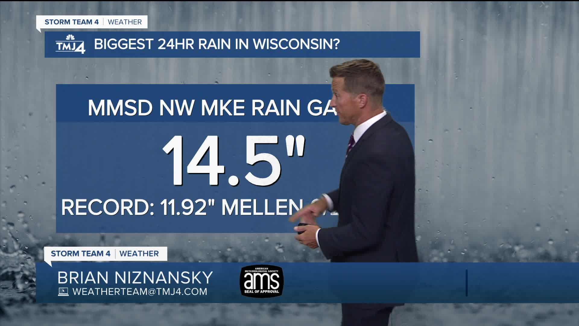


We've had a nice break from the rain today, but some area rivers continue to rise.
Additional rain expected tomorrow morning could quickly create ponding of water and brief rises in rivers once again. We are not expecting a repeat of the weekend historic flooding but could see up to 1" of additional rain.
There is a slight chance for storms popping up again tomorrow afternoon. Some really nice weather is on the way for midweek but we heat up again this coming weekend along with the chance for more storms
Watch: More rain around the corner:
TONIGHT: Slight Ch. T-Storms Late and Humid
Low: 70
Wind: S 5 mph
TUESDAY: Humid, Morning Sct'd Storms. Up to 1" Slight Ch. T-Storms Late
High: 83
Wind: sw 5-10 mph
WEDNESDAY: Mostly Sunny
High: 80
THURSDAY: Mostly Sunny
High: 80
FRIDAY: Partly Cloudy and Very Warm
High: 87
It’s about time to watch on your time. Stream local news and weather 24/7 by searching for “TMJ4” on your device.
Available for download on Roku, Apple TV, Amazon Fire TV, and more.
