

Not as warm today, but it's still quite mild for February. An area of low-pressure pivots across the state tonight. We're going to see just rain here in SE Wisconsin.
Plan on showers moving in after 7 pm this evening, arriving first for our western counties.
Scattered showers continue on and off through the night, especially north of Milwaukee. Don't be shocked to hear a few rumbles of thunder.
Watch: Find out when you’ll need your winter coat again:
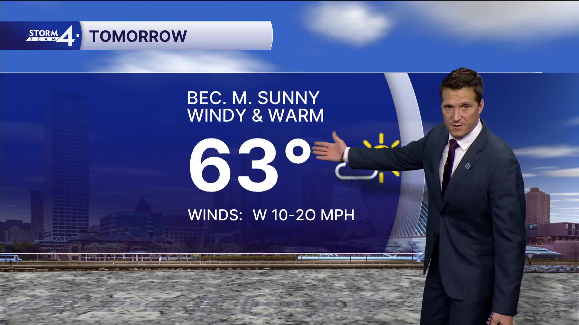
Another surge of warm air is expected tomorrow with high temperatures likely reaching 60 degrees again. We'll probably stay shy of the record high of 67 degrees.
Another storm system brings more rain to the area on Thursday then a potential wintry mix on Friday. Minor snow accumulation is possible here in southern Wisconsin, with a more significant snow to the north.
TONIGHT: Showers Likely. Maybe Thunder.
Low: 44
Wind: E to S 15-25 mph
WEDNESDAY: Bec. Mostly Sunny, Windy, and Warm
High: 63(Record 67)
Wind: W 15-25 mph
THURSDAY: Rain Likely
High: 50
FRIDAY: Mix Likely. Minor Snow Accumulation
High: 35
SATURDAY: Mostly Cloudy, Breezy, With Flurries
High: 33
It’s about time to watch on your time. Stream local news and weather 24/7 by searching for “TMJ4” on your device.
Available for download on Roku, Apple TV, Amazon Fire TV, and more.
