

It was a gray and dreary Christmas Eve in Southeast Wisconsin.
Snow has melted, and temperatures are sitting around 40 degrees for highs. A mild and cloudy stretch of weather will carry us through the holiday week.
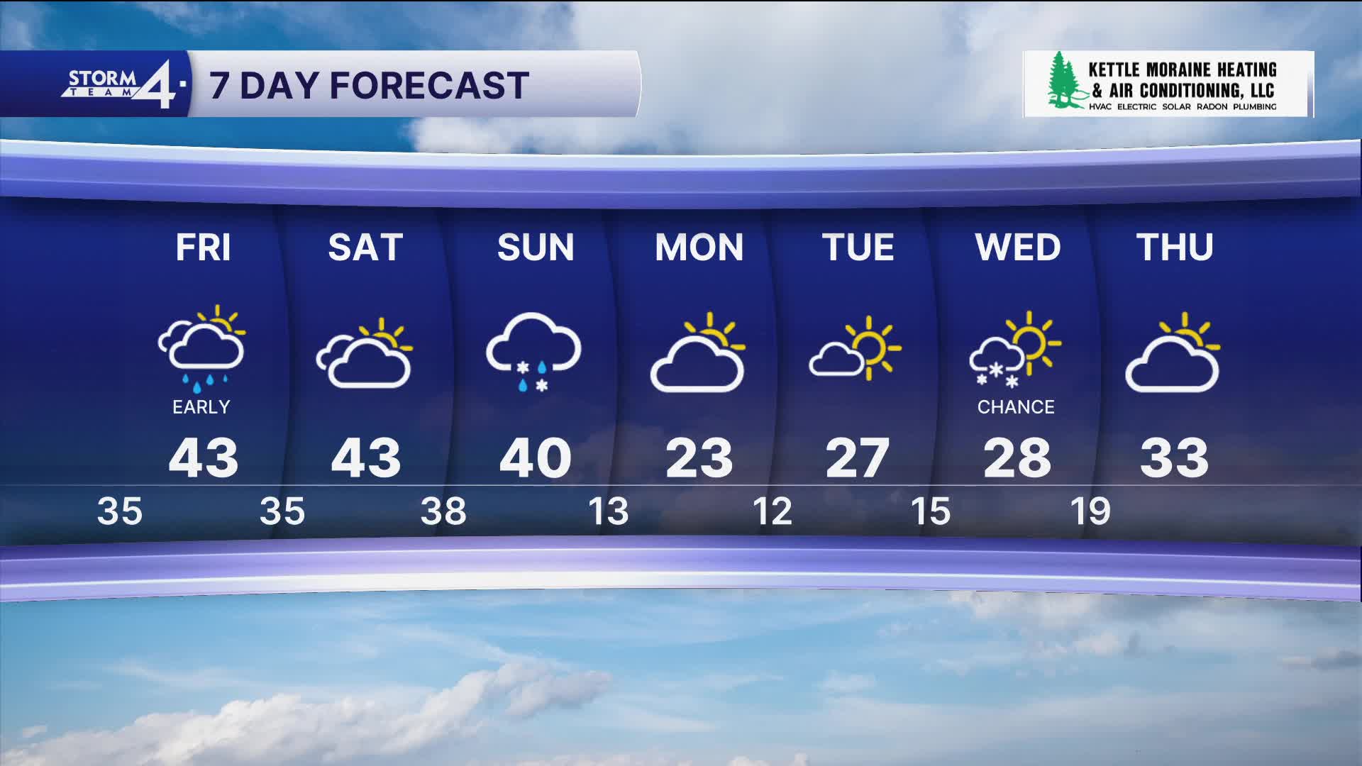
It was a quiet and mild Christmas day in Southeast Wisconsin. Again, temperatures came close to 40 degrees, and mostly cloudy skies.
Tonight, we have another round of showers possible. A clipper will move into Wisconsin, bringing some snow and wintry conditions to the northern half of the state. We can expect the precipitation to remain as liquid.
You may notice some fog on Friday morning. Take it slow and use caution on the roads.
Watch: When to expect a major cool-down
We have more clouds and 40s in store for Saturday. Winds are from the southeast around 5-10 mph.
Sunday will come with a big change in temperature. Morning temperatures should be near 40, but we fall to freezing by the afternoon. As this is happening, we are watching some rain and snow showers develop in the area.
Monday will be cold with high temperatures only reaching the low 20s. We slowly warm back up as we head into the new year!
WEDNESDAY NIGHT: Patchy Drizzle, Mainly South
Low: 34
Wind: N 5-10 mph
THURSDAY: Mostly Cloudy
High: 38
Wind:
FRIDAY: Chance AM Showers; Mostly Cloudy
High: 42
SATURDAY: Mostly Cloudy and Mild
High: 43
SUNDAY: Slight Chance Mix; Falling Temperatures
High: 35 (Falling into the 20s by evening)
MONDAY: Mostly Sunny
High: 20
It’s about time to watch on your time. Stream local news and weather 24/7 by searching for “TMJ4” on your device.
Available for download on Roku, Apple TV, Amazon Fire TV, and more.
