

Showers to our west will continue to dissipate as they approach southeast Wisconsin. We'll have a better chance of these showers holding together later tonight and into tomorrow morning.
Any rain should be light and scattered. We're also going to warm up on Friday! High temperatures should top 70 degrees.
Watch: When a cold front could make for a soggy weekend
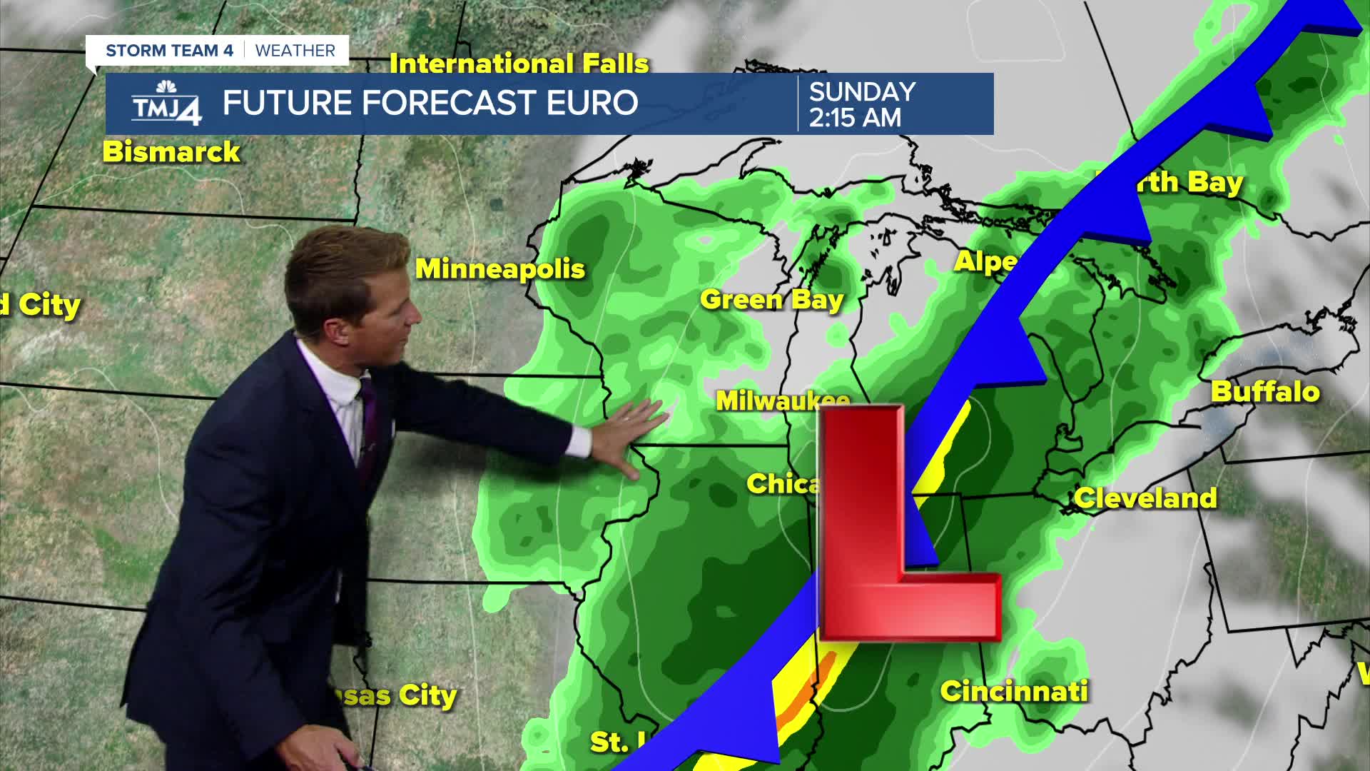
We continue to track and monitor a storm system that will likely move into the Great Lakes Region this weekend. Overall, the weekend forecast is improving.
First showers will be possible ahead of a cold front late Friday night and into Saturday morning. It now looks like we'll see a long break in rainfall Saturday afternoon and into Saturday evening.
As an area of low pressure develops, more rain is possible on Sunday morning and potentially lasting much of the day. It's also going to be windy this weekend with gusts over 30 mph.
TONIGHT: Mostly Cloudy with Slight Ch. Showers
Low: 54
Wind: SE 10 mph
FRIDAY: Ch. Showers Early then Partly Cloudy, Mild, and Breezy
High: 73
Wind S 10-15 mph
SATURDAY: Showers Likely, Mainly Early. Mild and Windy.
High: 71
SUNDAY: Windy and Cooler with Ch. Rain.
High: 58
MONDAY: Mostly Sunny
High: 62
It’s about time to watch on your time. Stream local news and weather 24/7 by searching for “TMJ4” on your device.
Available for download on Roku, Apple TV, Amazon Fire TV, and more.
