

Our temperatures were once again below normal on Wednesday. Many of us were stuck in the 50s. NW winds remain breezy, but at least we have sunshine.
Wednesday night, will be quiet and mild. Winds calm down, temperatures remain in the 40s as a few clouds build in.
Watch: How warm we can expect it to get as we get closer to the weekend.
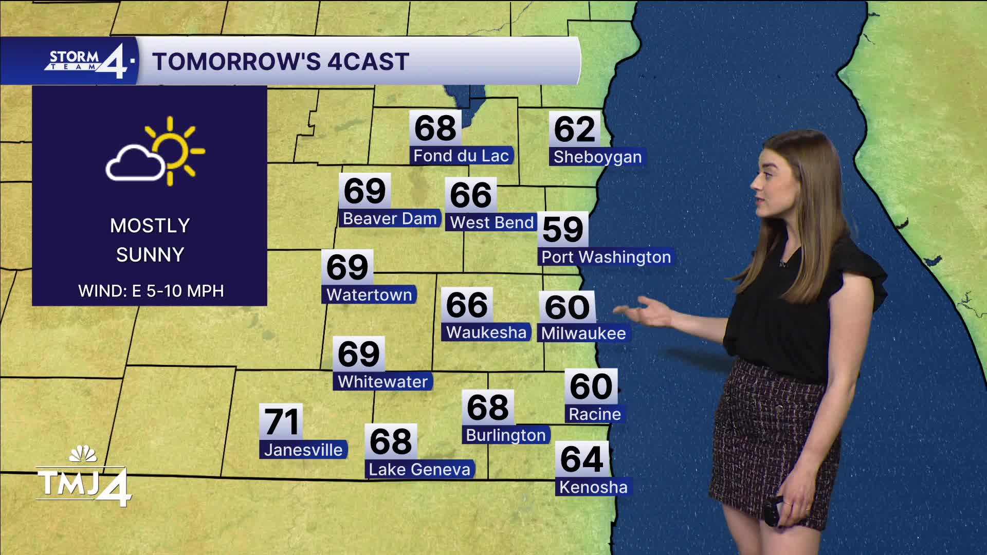
Thursday will be dry and cool. Highs will struggle to hit 60 lakeside, but mid-60s are likely inland. We get a break from the wind, as we can expect gusts less than 15 mph
A round of showers is expected first thing Friday. Highs jump into the mid-70s with strong southerly winds. We are back to winds at 10-20 mph gusting near 30 mph.
There is a slight chance for a bit of rain early Saturday before the sunshine and southerly winds allow highs to jump to near-80! Saturday will be the best weekend day with a true summer-like feel.
Sunday will be cooler with highs in the mid 60s. We will see more clouds and a chance for showers and storms.
As the forecast stands now, our best chance for severe weather is Monday.
Next week will be warmer and more active.
TONIGHT: Partly cloudy; light wind
Low: 41
Wind: Calm
THURSDAY: Mostly sunny
High: 60 lake, 65 inland
Wind: E 5-10 mph
FRIDAY: AM showers likely; partly sunny
High: 74
Wind: S 10-20 mph
SATURDAY: slight chance shower; mostly sunny and warm
High: 80
SUNDAY: Chance showers/storms; mostly cloudy
High: 67
MONDAY: Chance showers/storms
High: 80
It’s about time to watch on your time. Stream local news and weather 24/7 by searching for “TMJ4” on your device.
Available for download on Roku, Apple TV, Amazon Fire TV, and more.
