

What a cloudy and cool Sunday.
Our afternoon temperatures fell to the low 30s with wind gusts over 30 mph. Sunday night, there is a small chance for a few snowflakes. Overall, we see partly cloudy skies and temperatures in the 20s.
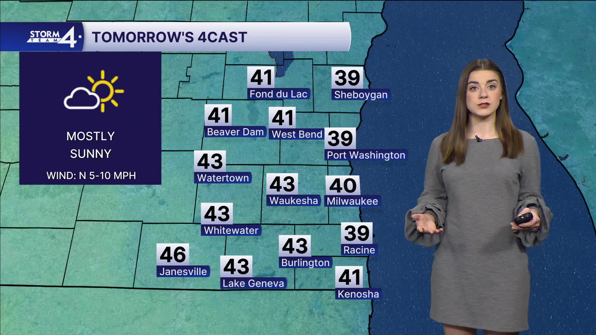
The sun returns on Monday. Highs will be in the mid 40s.
Watch: When will it warm up again in Southeast Wisconsin?
Highs make it to the 50s later this week.
This also comes with a chance for more rain. The best chance is Wednesday night into Thursday morning.
Mild conditions last into the weekend.
SUNDAY NIGHT: Mostly cloudy, chance snowflakes
Lows: 25
Wind: N 10-15 mph
MONDAY: Mostly sunny
High: 40
Wind: N 5-10
TUESDAY: Partly cloudy
High: 53
WEDNESDAY: Partly cloudy, rain possible late
High: 52
THURSDAY: Chance rain
High: 60
FRIDAY: Mostly cloudy
High: 40
It’s about time to watch on your time. Stream local news and weather 24/7 by searching for “TMJ4” on your device.
Available for download on Roku, Apple TV, Amazon Fire TV, and more.
