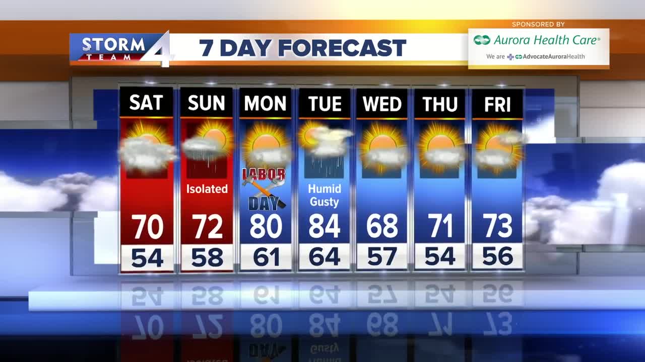


Saturday looks better in the fact that the rain holds off until evening, but it will be partly cloudy and cool with highs near 70 and a SE breeze off the lake.
Scattered showers are possible Saturday night into Sunday morning, then Sunday is mostly cloudy and humid with a high of 72. Labor Day is ideal for the unofficial end to summer with sunshine, humidity and highs near 80. Tuesday is steamy and 84 with scattered afternoon t’storms along a cold front. That front cools us into the 60s Wednesday.
HERE'S YOUR LATEST STORM TEAM WEATHER FORECAST FOR MILWAUKEE AND SOUTHEASTERN WISCONSIN:
TONIGHT: Clear skies and chilly
Low: 58 lakefront … 49 Inland
Wind: Calm
SATURDAY: Partly cloudy and cool with spotty showers by evening
High: 71
Wind: ESE 5-15 mph
SUNDAY: Scattered morning showers, then mostly cloudy, cool and damp
High: 72
Wind: SE 5-10 mph
MONDAY: Mostly sunny, warm and more humid
High: 80
Wind: SSE 5-10 mph
TUESDAY: Partly cloudy, warm and steamy with scattered t’storms
High: 84
Wind: SW 20-40 mph
WEDNESDAY: Mostly sunny, cooler and less humid
High: 68
Wind: NNE 10-15 mph
