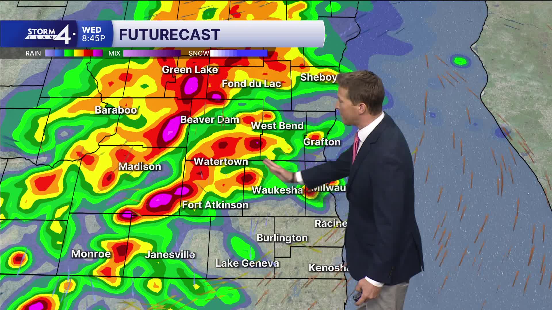


Showers have been very scattered and light this afternoon, but look for things to pick up again later this evening. We should expect another round of thunderstorms, with some being severe.
WATCH: Southeast Wisconsin weather: More storms and showers
The overall severe threat isn't as strong as last night, but damaging wind and hail will be possible. We also have to monitor isolated locations that may pick up heavy rain.
Flooding is a concern if these spots end up landing over locations that got hit hard last night. A few more showers may linger on Thursday, and yet another round of storms is on the table for Friday night.
HERE'S YOUR LATEST STORM TEAM WEATHER FORECAST FOR MILWAUKEE
AND SOUTHEASTERN WISCONSIN BY METEOROLOGIST BRENDAN JOHNSON
FLOOD WATCH UNTIL 1P FOR JEFFERSON, KENOSHA, MILWAUKEE, OZAUKEE, RACINE, WALWORTH, WASHINGTON & WAUKESHA COUNTIES
THURSDAY: Scattered AM Showers
High: 62 Lake 64 Inland
Wind: N 5-10 mph
TONIGHT: Mostly Cloudy
Low: 46
Wind: E 5 mph
FRIDAY: Partly Cloudy, Breezy, and Warm; Rain/Storms At Night
High: 70 Lake 74 Inland
SATURDAY: Becoming Partly Cloudy
High: 54
SUNDAY: Mostly Sunny & Cooler
High: 50
MONDAY: Mostly Sunny
High: 53
It’s about time to watch on your time. Stream local news and weather 24/7 by searching for “TMJ4” on your device.
Available for download on Roku, Apple TV, Amazon Fire TV, and more.
