

Sunday was an almost perfect January day.
Highs are near freezing, and we saw a mix of sun and clouds. Gusty winds left us with that cold, winter-like feeling.
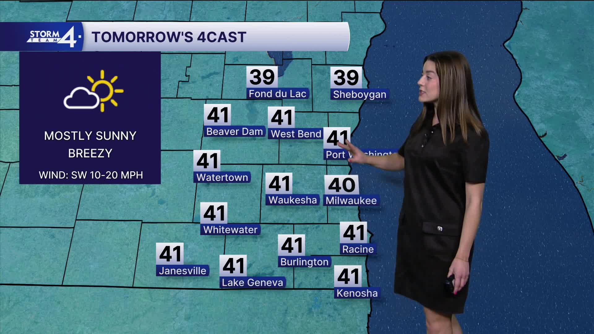
The sunshine sticks around for Monday.
Temperatures will climb above normal with southerly winds. Expect high temperatures to reach 40 degrees. We don't have any frigid temps in the coming week but there are signs we will close January with bitter cold.
We will see mostly cloudy skies and highs in the mid 40s on Tuesday.
Watch: When we could expect to see rain (and maybe some snow) this week.
A clipper system passes through on Tuesday. First with a chance for rain showers Tuesday night.
As temperatures plummet on Wednesday, there is a chance for snow. Highs on Wednesday and Thursday are in the mid 20s.
It is likely that we will see winter weather to end the week. Storm Team 4 will keep you updated on the track of a low-pressure system.
SUNDAY NIGHT: Partly Cloudy
Low: 20
Wind: SW 10-20 mph
MONDAY: Mostly Sunny
High: 42
Wind: W 10 mph
TUESDAY: Mostly Cloudy, Chance Rain Late
High: 45
Wind: W 10-20 G25
WEDNESDAY: Mostly Cloudy, Chance Snow
High: 28
THURSDAY: Partly Cloudy
High: 28
FRIDAY: Chance Snow
High: 32
It’s about time to watch on your time. Stream local news and weather 24/7 by searching for “TMJ4” on your device.
Available for download on Roku, Apple TV, Amazon Fire TV, and more.
